
Dreaming of a Himalayan adventure? The Pindari Glacier Trek is one of Uttarakhand’s most iconic glacier treks. In this Pindari Glacier Trek Guide, we’ll walk you through everything — from the route and difficulty to permits, itinerary and essential tips. Whether you’re a first‑time trekker or a seasoned hiker, this journey offers jaw‑dropping Himalayan views, lush valleys, and a touch of adventure that’s hard to beat. Pindari Glacier Trek Route The trek begins from villages like Loharkhet / Saung / Khati and winds through forested trails, rivers, meadows and remote Himalayan villages before reaching the glacier. Here’s a simplified breakdown of the common route: Segment Approx Trek Distance* What to Expect Loharkhet (or Saung) → Khati Vehicle + short walk Base‑camp, last motorable village Khati → Dwali ~ 8–13 km Valley trail along Pindar River, forest & villages Dwali → Phurkia / Phurkia camp ~ 7–11 km Valley gets narrower, closer to glacier region Phurkia → Zero‑Point / Glacier snout ~ 5 km Final stretch, glacier, snow, panoramic Himalayan peaks *Total trekking distance (round‑trip) ranges around 45–50 km per many operators. Altitude: The glacier sits at roughly 3,660 metres (12,000 ft) above sea‑level. The trail offers stunning views of Himalayan giants like Nanda Devi East, Nanda Kot and other Kumaon peaks. Pindari Glacier Trek Difficulty The Pindari Glacier Trek is often described as easy to moderate, making it a good choice for trekking beginners — yet also rewarding for experienced hikers. Pindari Glacier Trek Permits Best Time to Visit Brahmatal Trek Season Months What to Expect / Why Go Things to Note / Who It’s Best For Winter (Snow Trek) December – February / early March Snow‑covered trails, frozen lakes (like the frozen alpine lakes), pristine white landscapes, magical “winter‑wonderland” vibe, dramatic Himalayan peak views. Very cold (night temps can drop below freezing), need proper winter gear and some experience in cold‑weather trekking. Best for snow lovers and photographers. Spring (Transition to Green + Snow Patches) Late March – April (sometimes into early May) Melting snow, blooming rhododendrons and wildflowers, mix of snow‑touched trails + fresh green meadows — very scenic, and easier weather. Daytime weather milder, night chill persists. Some snow patches may remain — a good balance for those who want milder trekking with scenic variety. Autumn / Post‑Monsoon September – November Clear skies, crisp air, great mountain visibility, pleasant trekking conditions, fewer crowds, colourful autumn foliage or golden meadows depending on timing. Comfortable daytime temps, cooler nights. No snow, so easier walking. Ideal for trekkers avoiding snow yet wanting good views and calm trails. Summer / Monsoon May → September (monsoon July–August) Green surroundings, but generally not recommended for trekking — trails can become slippery, heavy rain or landslides make it risky. High rain risk, unstable trails, poor visibility of peaks. Best avoided unless you prefer heavy‑duty preparedness and don’t mind risks. Which Season Should You Pick? Quick Climate & Trail‑Condition Snapshot Why Pindari Glacier Trek is Ideal and Who Should Go Pindari Glacier Trek Itinerary Here’s a sample itinerary many trekkers follow — flexible depending on pace and group. Day Plan Day 0 / Arrival Reach base (e.g., Kathgodam → Loharkhet / Saung / Khati) Day 1 Reach Khati — last motorable village, check‑in, rest & gear prep Day 2 Trek Khati → Dwali (via forest, valley, river banks) Day 3 Dwali → Phurkia (ascending gradually) Day 4 Phurkia → Pindari Glacier (Zero Point) + explore glacier / views of Himalayan peaks Day 5 Return: Pindari → Phurkia → Dwali Day 6 Trek back to Khati, then drive to base / Kathgodam & departure How to Reach + Trek Info: Delhi → Brahmatal / Lohajung Route Segment / Leg Approx. Distance (km) Approx. Time / Notes Delhi → Kathgodam (railhead / road‑stop) 280 km 6–8 hours by train / bus / car from Delhi Kathgodam → Lohajung (base village for trek) 210–220 km 8–10 hours by shared taxi / road vehicle (mountain roads) Delhi → Lohajung (combined) 480–500 km (depends on exact route) 12–14 hours (drive/bus/train + mountain drive), often split over two segments to start relaxed Lohajung → Trek Trail Start (for Brahmatal Trek) 0 km — trek begins from Lohajung itself You usually stay overnight at Lohajung before the trek starts Typical Trek Route (From Lohajung to Brahmatal & Return) Trek Segment Approx. Distance from Lohajung Time / What to Expect* Lohajung → first camp (via forest) 4–6 km (varies by exact route) 3–5 hours — forest walk, gradual ascent Intermediate camp → Brahmatal lake / ridge 7 km from previous camp (total trek 10–12 km from Lohajung) 4–6 hours — steeper climb, alpine terrain, views of peaks Trek return / descent (to Lohajung) 10–12 km (return depending on route) 5–7 hours — descent through forest/ridge FAQ Q: What is the total distance of the Pindari Glacier Trek?A: The round‑trip trekking distance is approximately 45–50 km. Q: What is the highest altitude reached on this trek?A: About 3,660 metres (12,000 feet) — at the glacier snout / zero‑point. Q: What is the difficulty level? Is it suitable for beginners?A: The trek is rated “easy to moderate.” Basic fitness and stamina are required, but it’s considered a good trek for beginners and first‑timers. Q: When is the best time to do the Pindari Glacier Trek?A: April–June and September–October are best — offering pleasant weather, clear skies, and good visibility. Q: Do I need special permits for this trek?A: Yes — you need forest/entry permits, and valid ID proof; usually handled by trek operators or registered at base village. Why struggle with planning? Let Clan Stays make your next trip seamless. What makes Clan Stays stand out is our care for every detail, we craft custom itineraries that match your travel style, budget, and pace, so your trip feels uniquely yours. With our industry connections, you often get special deals, comfortable stays and local‑insider recommendations you won’t find online. We take care of logistics and planning so you don’t have to, leaving you free to relax and enjoy your holiday. And if anything, unexpected happens, we’re just a call
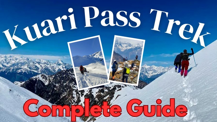
A Beginner’s Guide to Kuari Pass Trek in Uttarakhand
If you’re dreaming of snow-capped peaks, lush green meadows, and tranquil Himalayan trails, the Kuari Pass Trek Uttarakhand is perfect for you. Often called the “Curzon Trail,” this trek offers a mesmerizing combination of natural beauty, moderate challenge, and panoramic views. Whether you’re a first-time trekker or planning a short Himalayan getaway, this Kuari Pass Trek Guide will walk you through everything you need to know. Why Choose Kuari Pass Trek for Beginners? The Kuari Pass Trek for Beginners is popular because: Best Time to Visit Kuari Pass The Kuari Pass Trek Uttarakhand can be experienced in different seasons, each offering a unique landscape and trekking experience. Choosing the right time is crucial, especially for beginners, to ensure safe and enjoyable trekking conditions. Spring (March – May) Summer (June – July) Autumn (September – November) Winter (December – February) How to Reach Kuari Pass from Delhi Since Kuari Pass Trek Uttarakhand starts near Joshimath/Auli, the journey involves a combination of road and trekking. Here’s the breakdown: Route Segment Distance (km) Approx. Travel Time Mode of Transport Notes Delhi → Haridwar 220 km 5–6 hours Train / Bus / Car Haridwar is a major transit hub for Uttarakhand treks Haridwar → Rishikesh 20 km 30–45 mins Road Optional stop; famous for rafting and yoga Rishikesh → Joshimath 480 km 12–14 hours Bus / Taxi / Self-Drive Mountain roads; overnight journey recommended Joshimath → Auli 16 km 30–45 mins Cable car / Taxi / Jeep Auli is the base for Kuari Pass Trek Auli → Gorson Bugyal (Trek Start) 16 km 5–6 hours Trek Start of Kuari Pass Trek trail Gorson Bugyal → Kuari Pass 8 km 4–5 hours Trek Moderate trail; final stretch to Kuari Pass Why Kuari Pass Trek Stands Out Essential Gear for Kuari Pass Trek FAQs 1. How difficult is Kuari Pass Trek for beginners?It’s a moderate trek suitable for beginners with basic fitness. Daily trekking distance is 8–10 km. 2. What is the best season for Kuari Pass Trek Uttarakhand?March to June and September to November are ideal for clear views and pleasant weather. 3. Do I need a guide for Kuari Pass Trek?While optional, a local guide helps with navigation, safety, and camping arrangements. 4. What is the average cost of Kuari Pass Trek?Depending on the package, it ranges between ₹8,000–₹15,000 per person, including food, stay, and guide services. 5. Can I do Kuari Pass Trek in winter?Yes, but you need proper snow gear and winter clothing due to heavy snowfall. Let Clan Stays Take Care of All Your Travel Needs for a Stress-Free Vacation Let Clan Stays take care of all your travel needs so you can enjoy a stress-free vacation. From planning your itinerary to booking comfortable stays and local experiences, everything is handled for you. Their expert team makes sure your trip is smooth and hassle-free. With Clan Stays, you can focus on exploring new places and making great memories without any worries.

Dayara Bugyal Trek: Complete Guide, Itinerary, Best Time & Tips
If you crave an easy-to-moderate Himalayan adventure filled with sweeping alpine meadows and 360° mountain views, the Dayara Bugyal Trek is a perfect pick. This lush meadow trail in Uttarakhand offers a refreshing mix of forest walks, charming villages, and postcard-worthy peaks like Bandarpoonch and Srikantha. About Dayara Bugyal Trek The Dayara Bugyal Trek sits in Uttarkashi district at an altitude of ~11,800 ft (3,600 m). Known for its vast rolling meadows (bugyals), it is often considered one of the most beginner-friendly Himalayan treks.It’s also an all-season trail, making it a great alternative to the more crowded Kedarkantha and Nag Tibba treks. Dayara Bugyal Trek Itinerary (4–5 Days) Below is the most popular Dayara Bugyal Trek itinerary followed by most trekkers. Day 1: Dehradun → Raithal (7–8 hours’ drive) Altitude: 7,400 ftTip: Explore Raithal’s local temples and sunset points. Day 2: Raithal → Gui Campsite Trekking Distance: 4 kmTime: 3–4 hoursAltitude: 9,500 ft Day 3: Gui → Chilapada → Dayara Bugyal Campsite Trekking Distance: 6 kmTime: 4–5 hoursAltitude: 11,000 ft Day 4: Dayara Top Summit → Return to Raithal Trekking Distance: 8–9 kmTime: 6–7 hours Optional Day 5: Raithal → Dehradun Dayara Bugyal Best Time to Visit (Season-wise Guide) The beauty of Dayara Bugyal changes dramatically with each season, making it a year-round trekking destination. Here’s a detailed season-wise guide to help you choose the perfect time: Winter (December – February) Best for: Snow lovers, photographers, winter trekkers Why visit in winter?For the magical snow views and peaceful, crowd-free trails. Spring (March – April) Best for: Beginners, families, nature enthusiasts Why visit in spring?Ideal mix of mild snow patches, blooming forests, and comfortable weather. Summer (May – June) Best for: Camping lovers, long-weekend travellers Why visit in summer?For the full meadow experience at its greenest. Monsoon (July – August) Not recommended Why avoids monsoon?Low visibility, tougher trails, and safety concerns. Autumn (September – November) Best for: Photographers, experienced trekkers, clear views lovers Why visit in autumn?Best visibility, stable weather, and stunning golden landscapes. What Makes Dayara Bugyal Special? How to Reach Dayara Bugyal from Delhi (Table Format) Route Segment Distance (km) Travel Time Mode of Transport Notes Delhi → Dehradun ~250 km 5.5–7 hours Bus / Train / Car Overnight Volvo or Shatabdi recommended Delhi → Dehradun (Flight option) ~215 km (air route) 45–60 min Flight Land at Jolly Grant Airport Dehradun → Uttarkashi ~145 km 5–6 hours Bus / Shared Taxi / Private Cab Scenic but winding mountain roads Uttarkashi → Raithal ~40 km 1.5–2 hours Taxi / Shared Jeep Regular taxis available from Uttarkashi Total: Delhi → Raithal ~435 km 12–14 hours (overall) Combined Travel Raithal is the base village for the trek Best option: Delhi → Dehradun (train/bus) → Raithal (taxi) FAQs 1. How long is the Dayara Bugyal Trek? Typically, 4–5 days, covering around 20–22 km depending on the route. 2. Is the Dayara Bugyal Trek good for beginners? Yes! It’s one of the easiest Himalayan treks, perfect for first-time trekkers and families. 3. Can I do the trek in winter? Absolutely. Winter (Dec–Feb) turns the bugyal into a stunning snowfield, ideal for snow trekking. 4. Is camping allowed in Dayara Bugyal? Yes, but only in designated areas. Many groups camp at Gui, Chilapada, and around the upper meadow. 5. Are guides mandatory for the trek? Not mandatory but highly recommended for safety, navigation, and local support. Why Clan Stays Is the Go-To Travel Agency for Treks & Tours Clan Stays has earned the trust of travellers for its reliable and well-organized trekking and tour services. They offer personalized itineraries that suit beginners and experienced adventurers alike. With local expertise, safe arrangements, and comfortable accommodations, every trip is hassle-free and memorable. Their team ensures that you enjoy the beauty of the Himalayas while focusing on safety, convenience, and authentic experiences. Choosing Clan Stays means choosing a stress-free and unforgettable travel experience.

Deoria Tal Trek Guide: Everything You Need to Know
The Deoria Tal Trek is one of Uttarakhand’s most scenic and beginner-friendly treks, offering crystal-clear lake views and stunning reflections of Mt. Chaukhamba. Whether you’re trekking for the first time or looking for a short Himalayan escape, this Deoria Tal Trek Guide covers everything you need to know. From route details and difficulty to packing lists and preparation, this guide helps you plan your trip easily with practical Deoria Tal Trek Tips and essential trek information. Deoria Tal Trek Information The Deoria Tal Trek is known for its peaceful surroundings, dense forests, and the iconic reflection of snow-capped peaks on the lake’s surface. Below is a quick snapshot: Trek Feature Details Location Rudraprayag, Uttarakhand Altitude 2,438 meters Trek Distance 2.5 km (one way) Difficulty Easy Duration 1 Day or Overnight Camping Base Village Sari Village Best Season March–June, Sept–Dec Why One Should Visit Deoria Tal How to Reach Deoria Tal From Location Distance to Sari Village (km) Travel Time (By Road) Nearest Train Station Option Nearest Airport Option Delhi 420–450 km 10–12 hours Rishikesh / Haridwar Dehradun (Jolly Grant Airport) Dehradun 230 km 7–8 hours Rishikesh Dehradun Airport (same city) Rishikesh 190 km 6–7 hours Rishikesh Railway Station Dehradun Airport Haridwar 220 km 7–8 hours Haridwar Railway Station Dehradun Airport Rudraprayag 75 km 2–3 hours Rishikesh / Haridwar Dehradun Airport Ukshimath 28 km 1 hour Rishikesh / Haridwar Dehradun Airport Best Time to Visit Deoria Tal (Season-Wise) Deoria Tal is beautiful throughout the year, but the experience changes with every season. Here’s a simple breakdown to help you plan your trip better. Spring (March – April) Summer (May – June) Monsoon (July – September) Autumn (October – November) Winter (December – February) Deoria Tal Trek Route Overview Day 1 Day 2 Deoria Tal Trek Tips (Must Know Before You Go) Planning ahead can make your Deoria Tal trek safe, smooth, and enjoyable. Here are some essential tips: Deoria Tal Trek Preparation Preparing well ensures a comfortable trekking experience: Fitness and Training Permits and ID Weather Check Deoria Tal Trek Essentials Here is what you must carry for a safe and enjoyable trek: Clothing Gear Food & Hydration Optional FAQs 1. Is Deoria Tal Trek suitable for beginners? Yes, the trek is easy and ideal for beginners and families. 2. How long is the Deoria Tal Trek? The trek is 2.5 km one way and takes around 1.5 to 2 hours. 3. Can you camp at Deoria Tal? Yes, but only at the designated campsite near the lake—not right beside the water. 4. What is the best time for Deoria Tal Trek? March–June and September–December offers the best weather and views. 5. Do I need a guide for Deoria Tal Trek? Not mandatory, but helpful if trekking further to Chopta or Tungnath. What Makes Clan Stays a Reliable Travel Partner Clan Stays is a reliable travel partner because they make trekking safe, easy, and well-planned. Their trained guides help at every step, from choosing the route to supporting you during the trek. You get comfortable stays, good food, and quality gear, so you can enjoy your trip without stress. With small groups and personal attention, Clan Stays makes every trek smooth and enjoyable. Whether you’re new to trekking or have done many, you can trust them for a great experience.
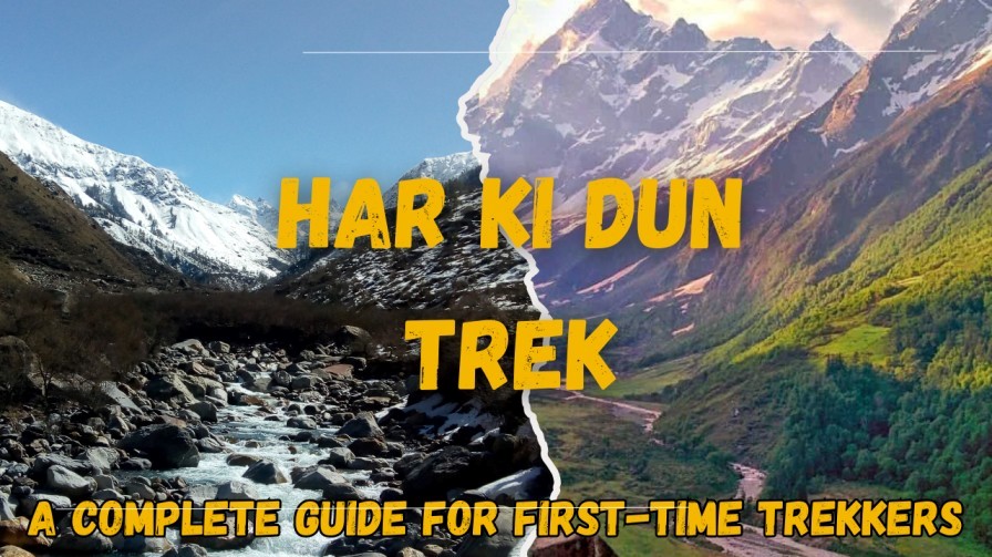
Har Ki Dun Trek: A Complete Guide for First-Time Trekkers
The Har Ki Dun Trek is one of the most scenic and beginner-friendly treks in Uttarakhand. Nestled in the Govind Pashu Vihar National Park, this trek offers lush green valleys, snow-capped peaks, and charming Himalayan villages. Whether you are a first-time trekker or looking for a short Himalayan adventure, this Har Ki Dun Trek Guide for First-Time Trekkers will cover everything from route details, trekking tips, and preparation advice to help you plan a smooth and enjoyable journey. Har Ki Dun Trek Information The trek is known for its natural beauty, historical significance, and accessibility for beginners. Here’s a quick snapshot: Feature Details Location Uttarkashi District, Uttarakhand Trek Length 25 km (round trip) Duration 5–6 days Altitude 3,566 meters (Har Ki Dun Valley) Difficulty Easy–Moderate Base Camp Sankri Village Best Season April–June, September–November Har Ki Dun Trek Preparation Proper preparation ensures a safe and enjoyable trek, especially for beginners. Fitness Gear and Essentials Permits and Documentation Har Ki Dun Trek Tips How to Reach Har Ki Dun From Location Distance to Sankri (km) Travel Time (By Road) Nearest Train Station Nearest Airport Delhi 500 km 12–13 hours Dehradun / Rishikesh Jolly Grant Airport, Dehradun Dehradun 200 km 7–8 hours Dehradun Jolly Grant Airport, Dehradun Rishikesh 180 km 6–7 hours Rishikesh Jolly Grant Airport, Dehradun Haridwar 220 km 7–8 hours Haridwar Jolly Grant Airport, Dehradun Uttarkashi 70 km 2–3 hours Dehradun Jolly Grant Airport, Dehradun Best Time to Visit Har Ki Dun (Season-Wise) Spring (March – June) Summer (May – June) Monsoon (July – August) Autumn (September – November) Winter (December – February) Why First-Timers Should Choose Har Ki Dun Why One Should Visit Har Ki Dun FAQs 1. Is Har Ki Dun Trek suitable for beginners? Yes, it’s ideal for first-time trekkers with moderate difficulty and well-marked trails. 2. How long does the Har Ki Dun Trek take? Typically, 5–6 days, depending on your pace and side explorations. 3. Do I need a guide for Har Ki Dun Trek? Guides are recommended for first-time trekkers for navigation and local insights. 4. What is the best season for Har Ki Dun Trek? April–June and September–November are the best seasons for clear views and pleasant weather. 5. Can families do Har Ki Dun Trek? Yes, families and groups of beginners can enjoy the trek with proper preparation. Why Clan Stays Is the Perfect Travel Partner for Your Trek Clan Stays is the perfect travel partner for your trek because they take care of every detail, making your journey safe and hassle-free. Their experienced guides ensure you follow the best routes and provide on-trail support at all times. With comfortable stays, quality gear, and small group sizes, every trek is personalized and enjoyable. Whether you are a beginner or an experienced trekker, Clan Stays ensures a smooth, memorable Himalayan adventure.
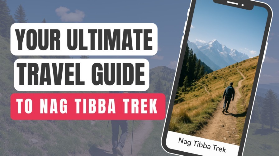
Your Ultimate Travel Guide to the Nag Tibba Trek
If you’re searching for a short, scenic, and adventure-packed Himalayan trek, this Nag Tibba Trek Guide is all you need. Known as the “Mountain of the Serpent”, Nag Tibba is one of Uttarakhand’s most popular weekend treks perfect for beginners, families, and adventure lovers. What Makes the Nag Tibba Trek So Special? The Nag Tibba Trek offers a rare mix of dense forests, snow-covered trails (in winter), and stunning 180° Himalayan views — all within a 2-day itinerary.Some highlights include: Nag Tibba Trek Details Below is a quick overview to help you plan your trip efficiently: Trek Feature Details Altitude 3,022 meters Difficulty Easy to Moderate Duration 2 Days / 1 Night Total Trek Distance ~16 km Base Camp Pantwari Village Best Time October–June (Snow in Dec–Feb) Nearest City Dehradun Nag Tibba Trek Itinerary (2 Days/1 Night) Day 1: Dehradun → Pantwari → Nag Tibba Base Camp Trek Time: 4–5 hoursDistance: 5–6 km Day 2: Base Camp → Nag Tibba Summit → Pantwari → Dehradun Trek Time: 6–7 hoursDistance: 10–11 km How Difficult Is the Nag Tibba Trek? The trail is suitable for beginners, though it includes some steep sections.Difficulty Breakdown: People with basic fitness can easily complete the trek. How to Reach Nag Tibba Nag Tibba is one of the most accessible Himalayan treks from Delhi, Dehradun, and Mussoorie. The trek starts from Pantwari Village, which serves as the base camp for most trekking routes. Below is a simple breakdown of how to reach Nag Tibba from major cities. Reach Dehradun (Nearest Major City) Dehradun is the main entry point for the Nag Tibba Trek. You can reach Dehradun by: By Bus By Train Popular trains: Travel time: 5–6 hours from Delhi By Flight Dehradun → Pantwari Village (Trek Starting Point) Pantwari is the official base camp for the trek. By Taxi By Shared Transport Alternative Route via Mussoorie You can also reach Pantwari via Mussoorie if you are staying there. Route: Mussoorie → Kempty Falls → Nainbagh → PantwariTime: 2.5–3 hours Tip: This route is scenic and preferred by travelers staying in Mussoorie. Reaching the Trek Start Point from Pantwari Once at Pantwari: Best Time to Visit Nag Tibba Nag Tibba is a year-round trek, but each season offers a different experience. Here’s what to expect in summer, winter, monsoon, and autumn. Spring (March – April) Best For: Clear skies, mild temperatures, first-time trekkersWhy Visit: Ideal for families, kids, and beginners. Summer (May – June) Best For: Adventure seekers, weekend getawaysWhy Visit: Temperatures range from 15°C to 25°C.Great time for photography and relaxed trekking. Monsoon (July – September) Best For: Offbeat travellersWhy Visit / Why Avoid: If you go, trek with experienced guides and take proper rain gear. Autumn (October – November) Best For: Best views, clear mountain skiesWhy Visit: Temperature: 8°C to 15°CThis is one of the best seasons to trek. Winter (December – February) Best For: Snow lovers, adventure enthusiastsWhy Visit: Difficulty increases due to snow, but still manageable with proper gear.Temperature can drop to -5°C at night. Overall Best Time to Visit Nag Tibba FAQ 1. Is the Nag Tibba Trek good for beginners? Yes! It’s one of the easiest Himalayan treks and perfect for first-time trekkers. 2. How long does the Nag Tibba Trek take? Usually 2 days and 1 night, making it ideal for weekend trips. 3. Is there snow in Nag Tibba? Yes, you can experience snow from December to February. 4. Are guides mandatory for the Nag Tibba Trek? Not mandatory, but recommended if you’re trekking for the first time or during winter. 5. What is the mobile network availability? Network is available till Pantwari; base camp and summit may have weak or no signal. Why Choose Clan Stays for Guided Himalayan Treks Choose Clan Stays for guided Himalayan treks because they make your journey safe, easy, and enjoyable. Their expert guides take care of everything from planning the route to helping you during the trek. You get good food, quality camping gear, and friendly support throughout the trip. Clan Stays keeps groups small so everyone gets personal attention. With them, you can relax, feel confident, and enjoy the mountains without any stress.
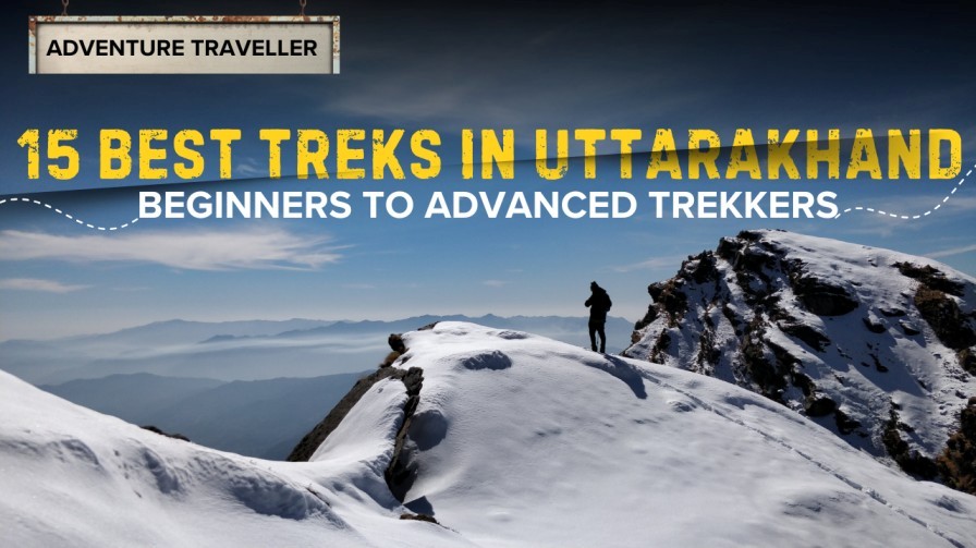
15 Best Treks in Uttarakhand for Beginners to Advanced Trekkers
Are you planning a Himalayan adventure but not sure where to start? This guide to the best treks in Uttarakhand covers everything from easy beginner-friendly trails to challenging expeditions for seasoned hikers. Whether you’re searching for best treks in Uttarakhand for beginners, difficult routes, or a complete Uttarakhand trekking guide, this list will help you plan your perfect mountain escape. Uttarakhand, known as the “Land of Gods,” offers some of the best Himalayan treks in Uttarakhand, rich with alpine meadows, glaciers, ancient temples, and snow-capped peaks. Let’s dive into the top 15 trails you must experience at least once in your life. Best Treks in Uttarakhand for Beginners If you’re planning your first Himalayan adventure, Uttarakhand offers some of the most scenic and beginner-friendly treks in India. These trails are short, safe, and packed with stunning views perfect for first-timers, families, and casual hikers. Here are the best treks in Uttarakhand for beginners: Nag Tibba Trek Nag Tibba is one of the most popular beginner treks in Uttarakhand. It offers dense forests, open meadows, and beautiful summit views of Swargarohini and Bandarpoonch. It’s a perfect weekend trek for first-timers. Chopta Tungnath – Chandrashila Trek This trek takes you to Tungnath, the highest Shiva temple in the world. The path is well-marked and beginner-friendly, ending with a stunning sunrise view from Chandrashila Peak. Deoria Tal Trek A short and beautiful woodland trail leads to Deoria Tal, a crystal-clear lake that reflects the Chaukhamba peak. It’s ideal for beginners, families, and nature lovers. Valley of Flowers Trek Perfect for nature enthusiasts, this UNESCO World Heritage Site is known for its colorful alpine flowers, lush meadows, and stunning Himalayan landscapes. Ideal for beginners who want a slightly longer trail. Kedarkantha Trek One of the most famous winter treks in India, Kedarkantha is perfect for beginners who want a snowy adventure. The trail is gradual, scenic, and leads to one of the best summit views in Uttarakhand. Bonus Beginner-Friendly Treks Moderate Treks in Uttarakhand Once you’ve completed a few beginner-friendly trails, it’s time to level up! Uttarakhand offers several moderate treks that balance adventure, altitude, and stunning Himalayan views without being overly technical. These routes are ideal for trekkers with basic fitness and some prior trekking experience. Below are the best moderate treks in Uttarakhand worth adding to your bucket list. Har Ki Dun Trek Har Ki Dun, also known as the “Valley of Gods,” is one of the most scenic trails in the Garhwal region. The route passes through ancient villages, terraced fields, pine forests, and open valleys. It’s perfect for trekkers who love nature, culture, and mythology. Highlights: Dayara Bugyal Trek Dayara Bugyal is one of India’s most beautiful alpine meadows. This trek is ideal for those stepping up from beginner treks and offers a blend of forests, meadows, and stunning Himalayan vistas. Why It’s Special: Kuari Pass Trek Kuari Pass, also known as the “Curzon Trail,” offers some of the best Himalayan views Uttarakhand has to offer. It’s a moderately challenging trek with ridge walks and forest trails. Trek Highlights: Brahmatal Trek A favourite among winter trekkers, Brahmatal features snow-covered trails, frozen lakes, and an adventurous ridge walk. It’s suitable for intermediates and offers exceptional mountain scenery. What to Expect: Pindari Glacier Trek Pindari Glacier is one of the most rewarding treks in the Kumaon region. The trail takes you through rural villages, suspension bridges, dense forests, and breath-taking glacier views. Best For: Bonus Moderate Treks in Uttarakhand Top Treks in Uttarakhand for Advanced Trekkers For experienced hikers seeking thrill, altitude, and remote wilderness, Uttarakhand offers some of the toughest high-altitude trails in the Indian Himalayas. These routes demand excellent fitness, technical skills, and strong mental endurance. If you’re ready to push your limits, these are the top treks in Uttarakhand for advanced trekkers. Roopkund Trek Roopkund, the mysterious lake of skeletons, is one of the most iconic high-altitude treks in India. The route features steep climbs, snowfields, and exposed ridges—making it ideal for seasoned trekkers. Highlights: Auden’s Col Trek Auden’s Col is a serious expedition route that connects the Gangotri Valley with the Kedarnath region. This trek involves technical glacier crossings, crevasse navigation, and extreme weather conditions. Perfect For: Kalindi Khal Trek Kalindi Khal is considered one of the toughest trekking routes in India—and for good reason. This expedition crosses massive glaciers between Gangotri and Badrinath, offering views of Shivling, Bhagirathi, and Satopanth peaks. Why It’s Legendary: Nanda Devi East Base Camp Trek This trek takes you deep into the heart of the Kumaon Himalayas. The trail is rugged, remote, and surrounded by towering peaks, offering a grand approach to Nanda Devi East. Best Features: Panchachuli Base Camp Trek A challenging but immensely rewarding trek, Panchachuli Base Camp offers spectacular views of the five magnificent Panchachuli peaks. The trek runs along the Dhauliganga River with steep sections and rugged terrain. Why Advanced Trekkers Love It: Other Challenging Treks for Experts How to Reach from Delhi + From Nearest Town Trek Name Nearest Town / Base Village Delhi → Nearest Town (KM / TR) Nearest Town → Base Village Nag Tibba Pantwari Delhi → Dehradun: 250 km / 5–6 hrs Dehradun → Pantwari: 85 km / 2 hrs Chopta–Tungnath–Chandrashila Chopta Delhi → Rishikesh: 240 km / 5–6 hrs Rishikesh → Chopta: 180 km / 5–6 hrs Deoria Tal Sari Village Delhi → Rishikesh: 240 km / 5–6 hrs Rishikesh → Sari: 190 km / 6 hrs Valley of Flowers Govindghat Delhi → Rishikesh: 240 km / 5–6 hrs Rishikesh → Govindghat: 275 km / 9–10 hrs Kedarkantha Sankri Delhi → Dehradun: 250 km / 5–6 hrs Dehradun → Sankri: 190 km / 6–7 hrs Dayara Bugyal Barsu/Raithal Delhi → Uttarkashi: 400 km / 9–10 hrs Uttarkashi → Barsu/Raithal: 30 km / 1 hr Har Ki Dun Sankri Delhi → Dehradun: 250 km / 5–6 hrs Dehradun → Sankri: 190 km / 6–7 hrs Kuari Pass Joshimath Delhi → Rishikesh: 240 km / 5–6 hrs Rishikesh → Joshimath: 255 km /
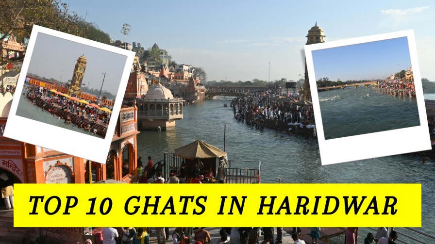
Top 10 Ghats in Haridwar Every Traveller Should Explore
Haridwar, one of India’s holiest cities, is famous for its ghats along the sacred Ganga River. For travellers seeking spirituality, culture, and local experiences, the Top 10 Ghats in Haridwar Every Traveller Should Explore offer a unique glimpse into the city’s vibrant traditions. These ghats are not just religious sites—they are bustling hubs of culture, daily rituals, and breath-taking riverside views. Whether you are a pilgrim, a photographer, or a curious traveller, the Haridwar Ghats for travellers promise unforgettable memories. Why Ghats in Haridwar Are a Must-Visit Ghats in Haridwar is central to the city’s spiritual and cultural life. They host: Top 10 Ghats in Haridwar to Visit Here’s a curated list of the must-visit Ghats in Haridwar for travellers: Har Ki Pauri Maya Ghat Gandhi Ghat Pawan Ghat Kankhal Ghat Raj Ghat Shitla Ghat Bheem Ghat Neel Dhara Ghat Chandi Ghat Tips for Visiting Ghats in Haridwar When to Explore Haridwar Ghats Most ghats in Haridwar are open 24 hours a day, allowing visitors to experience both morning rituals and evening Ganga Aarti. However, specific activities have recommended timings: Tip: Visiting during festivals like Kumbh Mela or Ganga Dussehra may have extended or special timings for ceremonies. Best and Worst Time to Visit Haridwar Ghats When to Visit When to Avoid FAQs 1. Which is the most famous ghat in Haridwar?Har Ki Pauri is the most famous ghat, known for its evening Ganga Aarti and spiritual significance. 2. Are the ghats safe for tourists?Yes, most ghats are safe, but visitors should be cautious near water and during crowded events. 3. Can visitors take part in the Ganga Aarti?Yes, tourists can observe and participate respectfully in the evening Aarti ceremonies. 4. What is the best time to visit Haridwar ghats?Early morning or evening is ideal, especially during festivals like Kumbh Mela for a vibrant experience. 5. Are there places to stay near the ghats?Yes, Haridwar offers a wide range of accommodations, from budget lodges to riverside hotels. Why Booking Through Clan Stays Ensures Safe and Smooth Travel? Booking through Clan Stays ensures a safe, smooth, and stress-free travel experience. With verified partners, reliable accommodations, and expert-planned itineraries, every trip is well-organized and hassle-free. Their 24/7 customer support provides assistance whenever needed, giving travellers peace of mind. Whether it’s a family vacation, solo adventure, or group tour, Clan Stays makes your journey comfortable, memorable, and truly enjoyable.
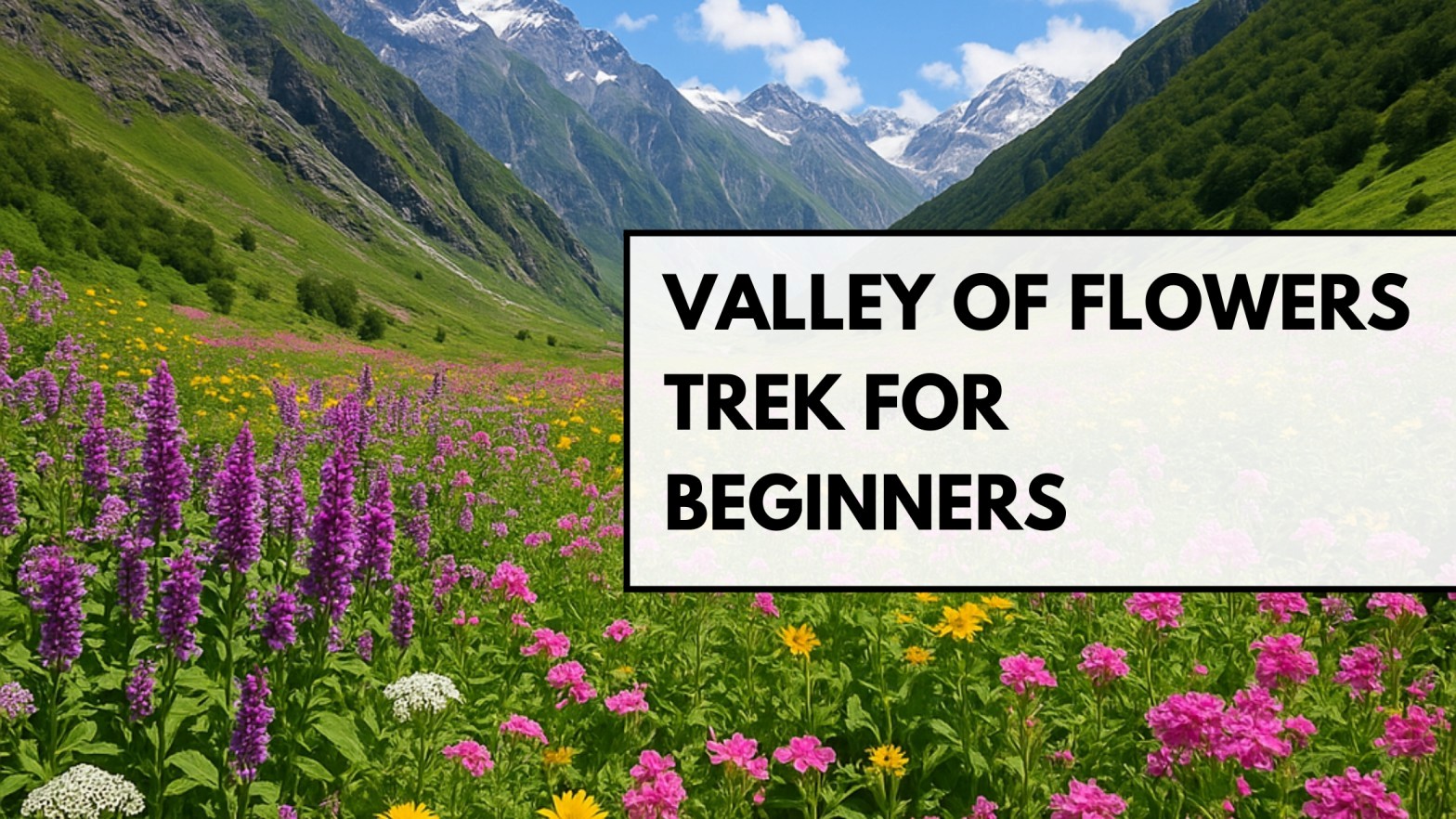
Valley of Flowers Trek for Beginners: Everything You Need to Know
If you’re dreaming of an easy yet breath-taking Himalayan adventure, the Valley of Flowers trek for beginners is the perfect start. Famous for its vibrant meadows, rare Himalayan flora, and peaceful surroundings, this UNESCO World Heritage Site welcomes thousands of trekkers every year.In this beginner-friendly guide, you’ll find all the Valley of Flowers trek details, preparation tips, itinerary, difficulty level, and more to plan your trip confidently. Why Valley of Flowers Is Perfect for Beginners The Valley of Flowers trek is one of the few Himalayan routes suitable for first-timers. The trail is well-marked, the ascent is gradual, and the landscapes are rewarding at every turn. Even without prior trekking experience, you can complete it comfortably with basic preparation. Difficulty Level of Valley of Flowers Trek The trek is rated easy to moderate, making it ideal for beginners.Here’s what you can expect: While the Valley of Flowers itself is easy, the optional extension to Hemkund Sahib requires a steeper climb perfect for those wanting an added challenge. Valley of Flowers Trek Height and Distance The Valley of Flowers trek is known for its moderate altitude and beginner-friendly distance. Here’s a detailed breakdown to help you plan your route with confidence. Total Trekking Distance The overall distance varies depending on whether you include Hemkund Sahib. Without Hemkund Sahib (Valley Only): With Hemkund Sahib (Optional Extension): This makes the trek manageable for beginners with basic fitness. Valley of Flowers Trek Altitude (Height) Location Height (Feet) Height (Meters) Govindghat (Start Point) ~6,300 ft ~1,920 m Ghangaria (Base Village) ~9,800 ft ~2,987 m Valley of Flowers ~11,500 ft ~3,505 m Hemkund Sahib (Optional) ~14,100 ft ~4,298 m The altitude gain is gradual, making acclimatization easier for first-time trekkers. Distance Breakdown by Day Route One-Way Distance Notes Govindghat → Ghangaria 13 km Moderate ascent, well-paved path Ghangaria → Valley of Flowers 4 km Easy trail, breath-taking meadows Ghangaria → Hemkund Sahib (optional) 6 km Steep climb, higher altitude Key Takeaways for Beginners Best Time for Valley of Flowers Trek (Season-Wise Guide) The Valley of Flowers opens only during summer and monsoon seasons, from June to September. Each season has its own charm, bloom level, and atmosphere. Here’s an easy breakdown to help beginners choose the perfect time. Early Summer (June) – Season Opening Bloom Level: LowWeather: Cool, fresh, and partly cloudyTrail Condition: Snow melts, path may be wet in a few spots Why visit in early summer? Best for: Trekkers who prefer calm, quiet trails over peak bloom. Mid-Summer (July) – Bloom Begins Bloom Level: ModerateWeather: Pleasant with light monsoon showersValley Landscape: Bright green meadows, early flowers blooming Why visit in mid-summer? Best for: First-time trekkers looking for colour and comfort. Monsoon Peak (Mid-July to Mid-August) – Best Season to Visit Bloom Level: Highest of the yearWeather: Regular monsoon rain but very refreshingValley Landscape: Explosive colours, 300+ flower species visible Why this is the BEST time: Best for: Everyone—especially beginners wanting the full experience. Late Monsoon (Late August to September) – Clear, Scenic, Quiet Bloom Level: Low to moderate (flowers start drying)Weather: Clear skies, crisp air, less rainfallValley Landscape: Bright views of surrounding peaks Why visit during late monsoon? Best for: Trekkers who love clear views and quiet trails. Season-Wise Summary Table Season Bloom Level Weather Crowd Level Best For Early Summer (June) Low Cool, fresh Low Quiet trekking Mid-Summer (July) Moderate Pleasant Moderate First-time trekkers Monsoon Peak (Mid-July–Mid-August) Highest Rainy & lush High Best overall Late Monsoon (Aug–Sept) Low–Moderate Clear & crisp Low Scenic views Valley of Flowers Itinerary for Beginners Day 1: Haridwar → Joshimath (8–9 hours) Beautiful drive through Devprayag, Rudraprayag, and the Alaknanda valley. Day 2: Joshimath → Govindghat → Ghangaria (13 km trek) A gradual ascent along the river. Overnight at Ghangaria. Day 3: Ghangaria → Valley of Flowers → Ghangaria Explore meadows, rare flowers, and serene landscapes.Trek Time: 4–5 hours. Day 4 (Optional): Ghangaria → Hemkund Sahib → Ghangaria Steep ascent but worth it for the lake and Gurudwara views. Day 5: Ghangaria → Govindghat → Joshimath Return trek and drive back. Day 6: Joshimath → Haridwar Drive back with unforgettable memories How to Reach Valley of Flowers Reaching the Valley of Flowers is quite straightforward, with multiple options via road, rail, and air. Most travellers first reach Haridwar or Rishikesh and then continue towards the base of the trek. By Air By Train By Road Trek Start How to Prepare for the Valley of Flowers Trek FAQs 1. Is the Valley of Flowers trek suitable for beginners? Yes, it is one of the most beginner-friendly Himalayan treks with moderate altitude and a well-marked trail. 2. How many days are needed for the Valley of Flowers trek? Most beginners complete it in 4–6 days, including travel. 3. Do I need a guide for the trek? Not mandatory, but helpful for safety, navigation, and local insights. 4. Is Hemkund Sahib compulsory? No. It’s an optional but rewarding extension for those comfortable with a steep climb. 5. What is the total trekking distance? Around 34–36 km if visiting only Valley of Flowers. Adding Hemkund Sahib increases it to ~46 km. Why Travelers Trust Clan Stays for Memorable Trips Travelers trust Clan Stays for well-planned, hassle-free journeys. They offer comfortable accommodations, expert local guidance, and easy-to-follow itineraries. With safety, transparency, and support for local communities, every trip is smooth and worry-free. Whether it’s trekking, leisure travel, or family vacations, Clan Stays makes every journey enjoyable and memorable.
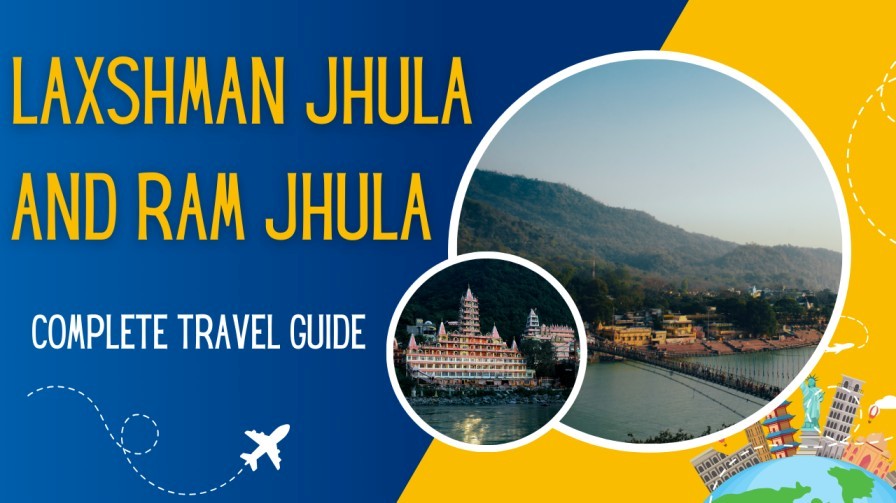
Ram Jhula and Laxman Jhula: Must-Visit Attractions for Every Rishikesh Traveller
If you’re planning a trip to Uttarakhand, Ram Jhula and Laxman Jhula: Must-Visit Attractions for Every Rishikesh Traveller should be at the top of your itinerary. These legendary suspension bridges are not only architectural marvels but also spiritual and cultural icons that define the charm of Rishikesh. Known collectively as Rishikesh iconic bridges, they attract millions of visitors every year. What Makes Ram Jhula and Laxman Jhula So Famous? The twin bridges of Rishikesh are more than just pathways across the Ganga River. They symbolize faith, adventure, and the timeless beauty of the Himalayas. Historical & Mythological Significance Both bridges hold immense spiritual value and are associated with the Ramayana era. Scenic Views of the Ganges & Himalayas Standing on either bridge, you’ll witness: This makes them ideal spots for photography and peaceful reflection. Hub for Ashrams, Temples & Yoga Centers These bridges connect some of Rishikesh’s most famous spiritual sites, including: Whether you’re on a spiritual quest or a yoga journey, the area around the Ram Jhula Laxman Jhula attractions is perfect for self-discovery. Best Things to Do Near Ram Jhula and Laxman Jhula Why Is Laxman Jhula Closed? Current Status & Updates What This Means for Travelers How to Reach Ram Jhula & Laxman Jhula By Air By Train By Road Best Time to Visit Explore Nearby Attractions Travel Tips for Visitors FAQs 1. Why are Ram Jhula and Laxman Jhula famous? They are iconic suspension bridges in Rishikesh known for their spiritual significance, scenic beauty, and proximity to temples and ashrams. 2. Is Laxman Jhula open for tourists? The old bridge was closed for safety reasons, but a new structure and nearby alternatives are available for visitors. 3. What is the best time to visit Rishikesh? October to March offers pleasant weather for sightseeing and adventure activities. 4. Are the bridges pedestrian-only? Yes, both Ram Jhula and Laxman Jhula are primarily pedestrian bridges, though bikes are sometimes allowed on Ram Jhula. 5. Can I visit both bridges in one day? Absolutely. They are just a few kilometres apart and easily walkable.