
Chakrata is one of the most peaceful hill stations in Uttarakhand. Surrounded by dense forests, waterfalls, and quiet mountain villages, it is perfect for travellers who want to escape crowded tourist places. This Chakrata Travel Guide will help you plan the perfect trip. From how to reach these hidden gems to the best time to visit, this guide covers everything you need to know. If you are planning a short mountain getaway, this Chakrata Trip Guide with Tiger Falls and Budher Caves will make your journey easier and more enjoyable. Why Visit Chakrata? Chakrata is a small cantonment town located about 90 km from Dehradun. Unlike busy hill stations like Mussoorie, Chakrata offers quiet landscapes, fresh air, and beautiful forest trails. Here are a few reasons why travellers love Chakrata: Tiger Falls: The Highest Waterfall in Uttarakhand Tiger Falls is one of the most beautiful waterfalls in the region. With a height of about 312 feet, it is considered one of the highest direct waterfalls in Uttarakhand. Why Tiger Falls is Special How to Reach Tiger Falls Tiger Falls is one of the most beautiful attractions near Chakrata and is famous for its scenic forest trek and tall cascading waterfall. Located about 20 km from Chakrata town, reaching Tiger Falls is fairly easy and suitable for most travellers. By Road The most convenient way to reach Tiger Falls is by road. You can drive or hire a taxi from Chakrata town. Route:Chakrata → Lokhandi → Tiger Falls Road Point The road journey takes around 45–60 minutes depending on traffic and weather conditions. The last point accessible by vehicle is the Tiger Falls parking area. Short Trek to the Waterfall After reaching the parking area, visitors need to walk down a 1 km forest trailto reach the base of the waterfall. Trek Details The trek offers beautiful views of the surrounding hills and thick deodar forests, making it a pleasant experience for nature lovers. By Taxi or Local Transport Local taxis are available in Chakrata that can take you directly to the Tiger Falls Road point. Many travellers also hire shared jeeps or private taxis for a day trip covering Tiger Falls and nearby viewpoints. Route from Major Cities Starting Point Distance to Chakrata Travel Time Dehradun 90 km 3–4 hours Mussoorie 75 km 3 hours Delhi 330 km 8–9 hours From Chakrata, it takes about 1 hour to reach Tiger Falls by road. Travel Tips Budher Caves: The Mysterious Limestone Caves Budher Caves are ancient limestone caves located near Chakrata. These caves are believed to have connections with the Mahabharata era. Legend says that the Pandavas stayed here during their exile. The caves are located inside dense forests, which makes the journey exciting and adventurous. What Makes Budher Caves Unique The caves are part of the famous Miola Top trekking route, offering beautiful views of the Himalayan ranges. How to Reach Budher Caves Budher Caves are one of the most fascinating natural attractions near Chakrata. These ancient limestone caves are surrounded by dense forests and open meadows, making the journey just as exciting as the destination. Budher Caves are located about 30 km from Chakrata town and require a short trek to reach the cave entrance. By Road from Chakrata The easiest way to reach Budher Caves is by road from Chakrata. Route:Chakrata → Lokhandi → Lohari Village → Budher Caves Trail Point The drive takes around 1.5 hours and passes through scenic forest roads and small villages. You can travel by private car, bike, or hire a local taxi from Chakrata. Trek to Budher Caves After reaching the road head near Lohari Village, visitors need to trek through a forest trail to reach the caves. Trek Details The trail passes through beautiful meadows and thick deodar forests. Many trekkers also combine this route with the Miola Top trek, which offers stunning Himalayan views. By Taxi or Local Transport Local taxis are available in Chakrata that can take you to the Budher Caves trek starting point near Lohari Village. Many visitors book a taxi for the entire day to explore both Tiger Falls and Budher Caves. Nearby Places to Explore in Chakrata Deoban Deoban is a peaceful forest area about 13 km from Chakrata, famous for its dense deodar trees and stunning Himalayan views. It is a perfect place for nature walks, bird watching, and quiet moments in nature. Chilmiri Neck Chilmiri Neck is the highest point in Chakrata and one of the best places to watch the sunset. Visitors can enjoy panoramic mountain views and a calm environment ideal for photography. Kanasar Kanasar is a scenic forest destination located about 25 km from Chakrata, known for its ancient deodar trees and lush greenery. It is a great spot for picnics, relaxing nature walks, and peaceful mountain views. Yamuna Adventure Park Yamuna Adventure Park offers exciting outdoor activities near the Yamuna River. Visitors can enjoy zip-lining, rope activities, and adventure experiences surrounded by beautiful natural scenery. Moila Top Moila Top is a beautiful meadow near Budher Caves that offers stunning views of the Himalayan ranges. The trek to this place passes through dense forests and open grasslands, making it a favourite for trekkers. Best Time to Visit Chakrata Chakrata is a beautiful hill destination that can be visited throughout the year. However, the best time depends on the type of experience you want, whether it is trekking, sightseeing, or enjoying snowfall. Summer (March – June) Summer is one of the best times to visit Chakrata as the weather remains pleasant with temperatures between 10°C and 25°C. It is perfect for exploring Tiger Falls, Budher Caves, and nearby trekking trails. Monsoon (July – September) During monsoon, Chakrata becomes lush and green with misty mountain views and flowing waterfalls. However, heavy rains may make trekking trails slippery, so travellers should plan carefully. Autumn (October – November) Autumn offers clear skies and stunning views of the Himalayan peaks, making it an ideal time for sightseeing and photography. The cool weather also makes
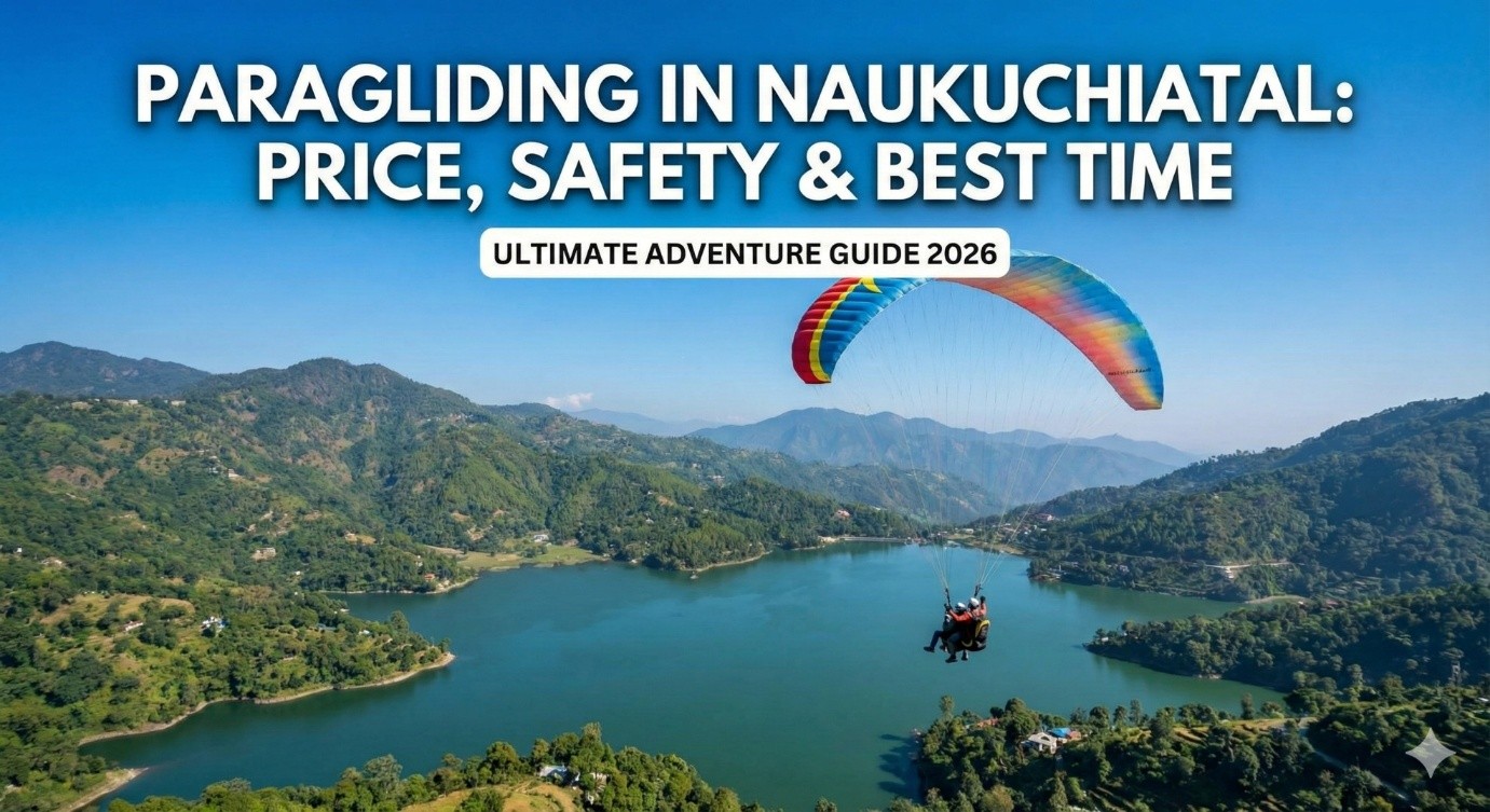
Paragliding in Naukuchiatal: Price, Safety & Best Time
Do you want to fly like a bird over a beautiful green lake? If yes, then Paragliding in Naukuchiatal is the best adventure for you! Naukuchiatal is a small, quiet hill station near Nainital. It is famous for its “Lake of Nine Corners.” But now, it is also very famous for adventure. Every day, hundreds of travelers come here to touch the sky. I have been in the travel line for 15 years, and I have seen many people feel scared before flying. But when they land, they are always smiling. In this blog, I will tell you the real Naukuchiatal paragliding price, safety tips, and the best time to go. Why Choose Naukuchiatal for Paragliding? You might think, why not fly in Bhimtal or Nainital? The answer is simple: The View. When you fly here, you see the full view of the Naukuchiatal Lake, which has nine corners. You also see dense green forests and small village houses. It is less crowded than Nainital, so you get more peace and better service. Also, the take-off point at Pandey Gaon is very high. This gives you a longer and smoother flight compared to other places nearby. Paragliding Cost in Naukuchiatal (2026 Updated Rates) Money is the first question everyone asks. The paragliding cost in Naukuchiatal depends on how much time you want to stay in the air. Here is a simple table to help you understand the rates: Type of Flight Duration (Time in Air) Approx Price (Per Person) Best For Short Fly 3 to 10 Minutes ₹1,500 – ₹2,500 Beginners & Kids Medium Fly 10 to 15 Minutes ₹2,500 – ₹3,500 Adventure Lovers High Fly 15 to 25 Minutes ₹4,000 – ₹5,500 Full Experience Long Fly 30+ Minutes ₹6,000+ Hardcore Thrill Seekers Local Tip: These rates can change during weekends or holidays. Always try to bargain a little if you are in a big group! Is Paragliding Safe in Naukuchiatal? This is the most important part. Many people ask me, “Is paragliding safe in Naukuchiatal?” The honest answer is: Yes, it is safe if you follow the rules. Here is why it is considered safe: Who Should NOT Fly? Best Time for Paragliding in Naukuchiatal You cannot fly 365 days a year. The weather plays a big role. 1. March to June (Summer): This is the best time for paragliding in Naukuchiatal. The weather is clear, and the wind is perfect. You can see the Himalayas clearly. 2. September to November (Autumn): After the rains, the nature is very green. The air is clean, and the views are amazing. This is my favorite time to visit. 3. Winter (December to February): You can fly in winter too, but it will be very cold. Make sure to wear a heavy jacket and gloves. When to Avoid: Do not plan for paragliding in July and August. This is the monsoon season. Due to heavy rain and clouds, paragliding remains closed. How to Reach the Paragliding Spot? The main paragliding spot is usually near Pandey Gaon. It is a little uphill from the main Naukuchiatal lake. Most paragliding operators provide a jeep ride. They will pick you up from the booking office, take you to the top of the hill for take-off, and bring you back after landing. Things to Carry for Paragliding You don’t need much, but keep these things in mind: Other Things to Do Near Naukuchiatal If you are done with flying, there is still a lot to do: Conclusion: Are You Ready to Fly? Paragliding in Naukuchiatal is an experience you will never forget. It gives you a bird’s eye view of the mountains and the beautiful lake. It is safe, affordable, and full of thrill. If you are planning a trip to Uttarakhand, make sure to add this to your list. And if you need a comfortable place to stay nearby, Clans Stays is always here to welcome you! Do you have more questions? Drop a message or comment below! FAQs About Paragliding in Naukuchiatal 1. What is the price of paragliding in Naukuchiatal? The price starts from ₹1,500 for a short fly and goes up to ₹5,500 for a high fly. 2. Is paragliding open in Naukuchiatal now? It is open most of the year except during the monsoon season (July-August) or bad weather days. 3. Can beginners do paragliding here? Yes! You will do “Tandem Paragliding,” which means a trained pilot will fly with you. You don’t need any prior experience. 4. What is the age limit for paragliding? Usually, anyone above 12 years old can fly. However, it depends on the child’s height and confidence. 5. How long does the flight last? It depends on your package. A short flight is 3-10 minutes, while a high flight can last 15-25 minutes. 6. Is video recording included in the cost? No, usually video recording is extra. Pilots charge between ₹500 to ₹1000 for a GoPro video. 7. What should I wear for paragliding? Wear comfortable jeans or trousers and sports shoes. Avoid sarees or skirts. 8. Is it safe for older people? If they are physically fit and have no heart issues, they can fly. But always consult the pilot first. 9. Can I book paragliding online? Yes, many websites offer online booking. But you can also book directly at the counter in Naukuchiatal or through your hotel.
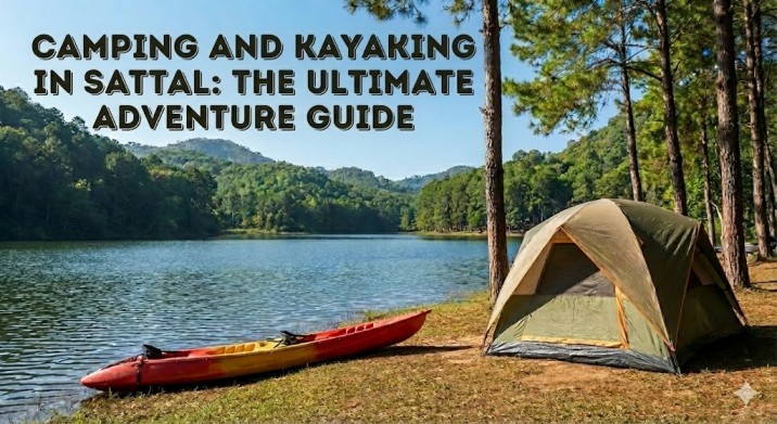
Camping and Kayaking in Sattal the Ultimate Adventure Guide
Nestled in the Kumaon region of Uttarakhand, Camping and Kayaking in Sattal offers an unforgettable mix of adventure and nature. Surrounded by dense oak and pine forests, Sattal is a hidden gem for travellers seeking peace with a thrill. From stargazing at lakeside camps to paddling across crystal-clear waters, Sattal camping and kayaking is perfect for couples, families, and adventure seekers alike. Why Choose Sattal for Camping and Kayaking? Sattal, meaning “seven lakes,” is less crowded than nearby Nainital. It is ideal for travellers who prefer offbeat destinations with authentic experiences. Top Reasons to Visit Sattal Camping in Sattal Uttarakhand combines relaxation and adventure in equal measure. Camping in Sattal Uttarakhand: A Complete Overview Camping in Sattal Uttarakhand is a peaceful experience surrounded by forests, hills, and freshwater lakes. It is ideal for travellers who want to enjoy nature away from busy tourist spots like Nainital. Most camps in Sattal are located near the lake or inside forest areas. These camps are designed to be eco-friendly and comfortable, making them suitable for beginners as well as families. Visitors can choose from different camping styles depending on their budget and comfort level. From basic tents to luxury camps with attached washrooms, there are options for everyone. Types of Camping Available in Sattal What Most Camping Packages Include Kayaking in Sattal Lake: Rates, Timings & Complete Information Kayaking in Sattal Lake is a calm and safe water activity, perfect for beginners and nature lovers. The quiet environment and clean water make it one of the most enjoyable experiences in Sattal. Kayaking is usually conducted under supervision, and basic instructions are given before entering the lake. Kayaking Timings in Sattal Kayaking is available on most days, depending on weather conditions. Morning hours are best for calm water and clear views. Kayaking may be stopped during heavy rain or strong winds. Kayaking Rates in Sattal Lake (Approximate) Kayak Type Duration Price (Per Person) Single Kayak 20–30 minutes ₹300 – ₹500 Double Kayak 30 minutes ₹500 – ₹800 Guided Kayaking 40–45 minutes ₹700 – ₹1,000 Prices may vary during weekends, holidays, and peak seasons. What is Included in the Kayaking Fee? Best Time for Camping and Kayaking in Sattal Choosing the right season is important to enjoy Camping and Kayaking in Sattal comfortably. Weather, lake conditions, and crowd levels change throughout the year, so planning ahead makes your trip better. Below is a clear season-wise breakdown to help you decide. Spring & Summer (March to June) – Best Season This is the best time for camping and kayaking in Sattal. The weather is pleasant, and lake conditions are perfect for water activities. What to Expect Best For Monsoon (July to September) – Green but Risky Monsoon brings lush greenery, but kayaking may be limited due to rain. What to Expect Best For Camping is available, but always check weather updates. Autumn (October to November) – Calm and Scenic Autumn is another great time for Sattal camping and kayaking. The weather is cool, and the surroundings are peaceful. What to Expect Best For Winter (December to February) – Cold but Beautiful Winter is quiet and scenic, but kayaking is limited. What to Expect Best For Routes, Train Stations & Airports to Reach Sattal from Delhi Travel Mode Main Route / Station / Airport Distance to Sattal Approx. Travel Time Notes By Road Delhi → Moradabad → Haldwani → Bhimtal → Sattal ~300 km 7–8 hours Best route with good roads; scenic hills after Haldwani By Train Kathgodam Railway Station (KGM) ~25 km 5–6 hrs (train) + 1 hr (road) Major railhead; frequent taxis and buses available By Air Pantnagar Airport (PGH) ~70 km 1 hr flight + 2 hrs drive Limited flights; pre-book taxi recommended Other Popular Sattal Adventure Activities · Nature Walks & Forest Trails: Explore serene forests and scenic trails. · Bird Watching: Spot over 500 species of local and migratory birds. · Cycling & Mountain Biking: Ride through hills and nearby villages. · Fishing: Enjoy peaceful fishing in Sattal’s freshwater lakes. · Photography & Stargazing: Capture sunrise, sunset, and clear night skies. FAQs 1. Is kayaking in Sattal safe for beginners? Yes, kayaking in Sattal Lake is beginner-friendly with calm waters and trained instructors. 2. What is the cost of camping and kayaking in Sattal? Packages usually range from ₹1,200 to ₹3,500 per person depending on inclusions. 3. Can families with kids visit Sattal? Yes, Sattal is safe and suitable for families and children. 4. Is advance booking required for Sattal camping? Advance booking is recommended during weekends and peak seasons. 5. Are pets allowed at Sattal camps? Some camps are pet-friendly, but it’s best to confirm in advance. 6. Do camps provide meals? Most camps include dinner and breakfast with local vegetarian food. 7. Is Sattal crowded like Nainital? No, Sattal is much quieter and less commercialized compared to Nainital. Why Travelers Trust Clan Stays for Sattal Camping & Kayaking Clan Stays is trusted by travellers for Sattal camping and kayaking because of its strong local experience and reliable planning. They work with trained guides and safe operators to ensure a smooth and secure adventure. From clean campsites to guided kayaking in calm lake waters, everything is well managed. Transparent pricing and clear communication help travellers plan without confusion. With personalized support, Clan Stays makes every Sattal trip comfortable and memorable.

5 Best Things to Do in Shivpuri (Beyond Rafting)
Most people come to Shivpuri for just one reason: River Rafting. It makes sense. The rapids here are world-famous. But, let me ask you something. What if you are scared of water? What if you have already done rafting and want something new? Or what if you just want to relax? I have been working in the travel industry for 15 years, and I have seen Shivpuri change from a small village to a major hub. I run Clans Stays, and I meet travelers every day who ask me, “Mayank, what else can we do here?” The truth is, Shivpuri has much more to offer than just rubber boats. From high-speed adventure activities in Shivpuri to quiet corners for meditation, this place has it all. Here is my personal list of the top 5 things to do in Shivpuri that will make your trip memorable, even if you never touch a paddle. 1. Feel the Thrill with Bungee Jumping and Giant Swing If you think rafting is the only way to get your heart racing, think again. Shivpuri has become a hotspot for extreme sports. Several adventure parks here offer activities that are safe and very exciting. This is perfect for the younger crowd or groups of friends. You don’t need to know swimming. You just need a bit of courage. Popular Activities: These activities are run by certified experts. They use high-quality gear from countries like New Zealand. Cost Estimate for Adventure Activities: Activity Approx Cost (Per Person) Time Taken Bungee Jumping ₹3500 – ₹4000 1 – 2 Hours Giant Swing ₹3000 – ₹3500 1 Hour Reverse Bungee ₹1200 – ₹1500 15 Minutes Zip Line ₹1500 – ₹2000 30 Minutes My Local Tip: Book these slots in the morning. The wind picks up in the afternoon, and sometimes they have to pause operations. 2. Trek to the Beautiful Neer Garh Waterfall If you love nature but hate crowds, this is for you. Neer Garh Waterfall is one of the most beautiful Shivpuri tourist places. It is not exactly in the main market, but very close by (about 5-6 km away). The trek starts from the road and goes up into the hill. It is not a very hard trek. Even families with kids can do it easily. The path is green and full of trees. When you reach the top, you see crystal clear water falling into small pools. Why you should visit: This is a great morning activity. Go there around 9 AM, spend two hours, and come back for lunch. 3. Find Peace at Vashistha Gufa (Cave) For my clients who come from busy cities or my NRI guests who want “real peace,” I always suggest this place. Vashistha Gufa is an ancient cave located on the banks of the Ganga. It is about a 15-minute drive from the main Shivpuri camping area towards Kaudiyala. According to history, the great Sage Vashistha meditated here. When you enter the cave, it is completely dark and silent. You can sit there for 10 or 20 minutes and close your eyes. The only sound you hear is your own breath. What to do here: Note: Please dress modestly here and keep your phone on silent. It is a spiritual place, not a picnic spot. 4. Go for “Cafe Hopping” with Mountain Views Ten years ago, you could only find Dal Makhani and Maggi in Shivpuri. Now, things have changed. A nice cafe culture is growing here. If you are a couple or a solo traveler, spending an afternoon in a cafe is one of the best things to do in Shivpuri. These cafes are built on the edge of the hills. You get a direct view of the river and the mountains. You can order a cappuccino, a pizza, or a smoothie bowl and just read a book. The vibe is very similar to places like Kasol or Landour now. What to try: 5. Enjoy a Staycation (Camping & Bonfire) Sometimes, the best activity is to do nothing at all. As the founder of Clans Stays, I see many guests who book a camp just to sleep, eat, and relax. Camping in Shivpuri is an experience in itself. You don’t always need to run around. We have luxury tents now that have attached washrooms, air coolers, and even swimming pools. Your Evening Plan: This is perfect for families who want to spend quality time together without the noise of the city. Choosing the Right Stay: Type of Stay Best For Facilities Beach Camp Bachelors/Students Basic tents, sand, common washroom Luxury Camp Families/Couples AC, attached washroom, pool, garden Riverside Resort Luxury Seekers/NRIs Premium rooms, room service, private balcony Conclusion So, is Shivpuri only for rafting? Absolutely not. Whether you want the adrenaline rush of bungee jumping in Shivpuri, the peace of Vashistha Gufa, or just a lazy weekend at a luxury camp, this place has something for everyone. I have spent years exploring every corner of this town. My advice? Don’t just come for a day. Stay for a weekend, breathe the fresh air, and enjoy the mountains. Ready to plan your trip? If you need help choosing the right camp or booking safe adventure activities, feel free to contact us at Clans Stays. We will sort it out for you. Frequently Asked Questions (FAQs) Q1: What are the best things to do in Shivpuri for families? A: Families can enjoy the Neer Garh Waterfall trek, visit Vashistha Gufa for peace, or book a luxury camp with a swimming pool. Adventure activities might be too intense for small kids. Q2: Is Bungee Jumping in Shivpuri safe? A: Yes, it is safe. The operators use high-standard equipment and have certified jump masters. However, always check the weight and age limits before booking. Q3: How far is Neer Garh Waterfall from Shivpuri? A: Neer Garh Waterfall is about 5 to 6 km from the main Shivpuri market. You can drive up to the starting point and then trek for 20-30 minutes. Q4:
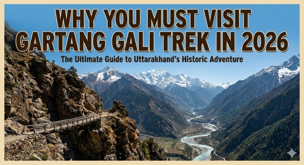
Why You Must Visit Gartang Gali Trek in 2026: The Ultimate Guide
Imagine walking on a wooden bridge that hangs high on a steep cliff. Below you, a river flows fast. Above you, there are tall mountains. The path is narrow, and the view is scary but beautiful. This is the Gartang Gali Trek. For many years, no one was allowed to go here. It was a secret path. But now, it is open for you. If you love adventure and history, this place is a must-visit in Uttarakhand. In this blog, I will tell you everything about the Gartang Gali Trek. I will share the opening dates for 2026, the ticket price, how to reach, and where to stay. I am sharing this from my own experience of 15 years in travel, so you can trust this guide completely. What is Gartang Gali? Gartang Gali is not just a bridge. It is a piece of history. It is a 136-meter-long wooden bridge built on a vertical rock face. It looks like a balcony hanging in the sky. The Amazing History Over 150 years ago, traders used this path. These traders, called Pathans, came from Peshawar (now in Pakistan). They built this bridge to trade goods like salt, wool, and spices between India and Tibet. It was part of the old Silk Route. In 1962, after the war between India and China, the government closed this bridge. No one used it for almost 60 years. The wood rotted, and the path became dangerous. But in 2021, the government repaired it. They used strong Deodar wood to make it safe again. Now, you can walk on the same path where traders walked 100 years ago. Quick Facts at a Glance Before you plan your trip, here are the key details you need to know. Feature Details Location Nelong Valley, Uttarkashi (near Gangotri) Altitude 11,000 feet (approx.) Trek Distance 2.5 km (one way) Difficulty Level Easy to Moderate Ticket Price (Indian) ₹150 – ₹200 (approx.) Ticket Price (Foreigner) ₹600 – ₹850 (approx.) Opening Time 9:00 AM to 4:00 PM Best Time to Visit May to June & September to October Gartang Gali Opening Dates 2026 The Gartang Gali Trek is not open all year round. In winter, the area gets very heavy snowfall. The roads get blocked, and the bridge becomes unsafe. For 2026, the expected opening date is around April 15, 2026. The exact date depends on the weather. If there is less snow, it might open a few days early. If there is heavy snow, it might open in May. Always check the local news or ask your travel agent before leaving. How to Reach Gartang Gali Reaching the start point of the Gartang Gali Trek is an adventure in itself. The start point is Lanka Bridge, which is near Bhaironghati. It is about 90 km from Uttarkashi main town. Here is the best way to reach there: 1. By Air The nearest airport is Jolly Grant Airport in Dehradun. 2. By Train The nearest railway stations are Rishikesh or Dehradun. 3. By Road (The Most Popular Way) Most people drive or take a taxi. The route is very scenic. You will see the river Bhagirathi flowing with you. The Route: Dehradun -> Mussoorie -> Chinyalisaur -> Uttarkashi -> Bhatwari -> Harsil -> Lanka Bridge (Start Point). Pro Tip: Do not try to go from Dehradun to Gartang Gali in one day. It is too tiring. Stay the night in Harsil or Uttarkashi. The Trekking Experience: Step-by-Step Let me describe what it feels like to do the Gartang Gali Trek. Step 1: The Check Post You start at Lanka Bridge. There is a forest check post here. You have to show your ID card (Aadhar Card is best). You pay the entry fee here. They will check your bag to ensure you are not carrying plastic bottles or alcohol. Step 2: The Forest Trail The first part of the trek is through a dense forest. It is a mix of Pine and Deodar trees. The path goes up and down, but it is not very steep. You will walk for about 1.5 km to 2 km on a dirt path. It is peaceful and quiet. You can hear the birds singing. Step 3: The Wooden Bridge (The Main Part) Suddenly, the forest ends, and you see the cliff. Here begins the famous Gartang Gali wooden bridge. You walk on this wooden path for about 136 meters. This is the best place for photos. You can see the Nelong Valley ahead. Step 4: The End Point The bridge leads to a small open area. This used to be a resting point for traders. You can sit here, drink some water, and enjoy the view. You cannot go further towards the China border without a special permit. From here, you turn back and return the same way. Ticket Price and Permits You do not need to book online months in advance like Kedarnath. You can get the permit on the spot at the Lanka Bridge Check Post. Note: The forest department is strict about time. If you reach after 3:00 PM, they will not let you enter. Best Time to Visit Gartang Gali Choosing the right time is very important for a good view and safety. Summer (May to June) This is the best time. The weather is pleasant. The days are sunny. The snow has melted, and the valley looks green. It is perfect for trekking. Monsoon (July to August) Avoid this time if possible. The roads in the mountains can get blocked due to landslides. The wooden bridge can get slippery when wet. Autumn (September to November) This is my favorite time. The sky is crystal clear blue. The trees start turning yellow and orange. The air is crisp and cold. It is very beautiful for photography. Winter (December to March) The trek is CLOSED. The area is covered in snow. Where to Stay? There are no hotels exactly at Gartang Gali. You have to stay in nearby towns. 1. Harsil
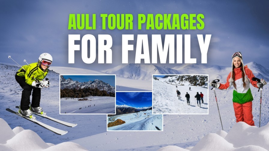
Auli Tour Packages for Family – Best Itineraries, Prices & Inclusions
Planning a refreshing Himalayan vacation? A family-friendly Auli tour package from Delhi is one of the best ways to enjoy snow adventures, nature walks, and peaceful mountain views. Auli, known as India’s skiing paradise, promises a relaxing yet adventure-packed getaway for all age groups. Auli is loved for its well-maintained slopes, cable car rides, and serene environment. It’s safe, scenic, and full of activities that kids, adults, and seniors can enjoy together. Why Choose Auli for a Family Trip? Auli is one of the safest and most picturesque destinations for a mountain holiday, making it perfect for families planning an Auli tour package from Delhi. The town offers gentle ski slopes, scenic ropeway rides, and peaceful viewpoints ideal for children and parents alike. With easy connectivity, pleasant weather, and plenty of activities, Auli ensures a comfortable and enjoyable travel experience for all age groups. Its mix of adventure and calm surroundings makes it a top choice for a memorable family vacation. Season-Wise Auli Visit Guide Winter (December to March) – Best for Snow Adventures Winter is the peak time for an Auli tour package from Delhi, as the entire region turns into a snowy wonderland. Families who love snow activities will enjoy this season the most, with picture-perfect landscapes and cold, refreshing weather.Activities to Enjoy: Summer (April to June) – Best for Family Sightseeing Summer in Auli offers pleasant temperatures, making it ideal for relaxed family vacations. Green slopes, clear skies, and gentle breezes create a peaceful atmosphere for kids and elders alike.Activities to Enjoy: Monsoon (July to September) – Best for Nature & Peace Seekers Monsoon brings misty clouds, lush greenery, and a calm environment—great for those wanting a peaceful getaway. Although it’s not peak tourist season, Auli looks breath-taking after the rains.Activities to Enjoy: Autumn (October to November) – Best for Clear Views & Mild Weather Autumn is perfect for families who want clear Himalayan views without extreme temperatures. The weather stays stable, making it comfortable for sightseeing and outdoor adventures.Activities to Enjoy: How to Reach Auli By Air The closest airport to Auli is Jolly Grant Airport, Dehradun, located around 270 km away. By Road The Auli to Rishikesh distance is around 260 km, offering a scenic drive through the Himalayas. Auli Ropeway Information Most visitors stay in Joshimath. The Joshimath to Auli distance is about 13 km, but many prefer the popular Auli Ropeway, one of Asia’s longest cable car rides. Top Places to Visit in Auli – Family-Friendly Activities 1. Auli Ropeway The famous ropeway is a must for any Auli tour package from Delhi, offering breath-taking views of snow-capped peaks and lush valleys.Activities by Season: 2. Gorson Bugyal This beautiful meadow is perfect for a family picnic or an easy trek during your Auli trip.Activities by Season: 3. Auli Artificial Lake A serene lake surrounded by mountains, ideal for families looking for calm spots.Activities by Season: 4. Chenab Lake A hidden gem near Auli, offering peaceful views and nature exploration.Activities by Season: 5. Narsingh Temple (Joshimath) A spiritual and cultural stop on any family trip, perfect for introducing kids to local traditions.Activities by Season: Best Auli Tour Itineraries for Families 3N/4D Auli Family Tour Package (Most Popular) Ideal for: Families with kids or senior citizensPrice Range: ₹12,500 – ₹22,500 per person Itinerary Day 1: Delhi → Rishikesh → Joshimath Day 2: Joshimath → Auli Day 3: Auli sightseeing & Gorson Bugyal Trek (easy) Day 4: Return to Delhi 4N/5D Auli + Rishikesh Package Ideal for: Families who want adventure + relaxationPrice Range: ₹16,000 – ₹28,000 per person Highlights: 5N/6D Auli, Chopta & Tungnath Family Adventure Ideal for: Nature-loving familiesPrice Range: ₹20,000 – ₹32,000 per person Attractions: Auli Tour Package Price Comparison Package Type Duration Ideal For Price (Per Person) Budget Family Package 3N/4D Small families ₹12,500 – ₹15,000 Standard Package 4N/5D Kids & seniors ₹17,000 – ₹22,000 Premium Package 5N/6D Multi-family groups ₹25,000 – ₹32,000 Luxury Package 3N/4D Comfort lovers ₹35,000 – ₹48,000 Inclusions in Most Auli Family Tour Packages Most packages include: Optional add-ons: Travel Tips for a Smooth Auli Family Trip 4-Day Auli Tour Package from Delhi Day 1: Delhi → Rishikesh → Joshimath Day 2: Joshimath → Auli Day 3: Gorson Bugyal Trek + Auli Lake Day 4: Return to Delhi FAQs 1. What is the best time to visit Auli for a family trip? The Auli best season to visit is December to February for snow and April to June for pleasant weather. 2. How far is Auli from Rishikesh? The Auli to Rishikesh distance is around 250 km, taking 8–9 hours by road. 3. What is the distance from Joshimath to Auli? The Joshimath to Auli distance is 4 km by ropeway and around 13 km by road. 4. Is Auli good for kids and senior citizens? Yes, Auli is safe and family-friendly with easy walks, beautiful viewpoints, and ropeway access. 5. What is the closest airport to Auli? The closest airport to Auli is Jolly Grant Airport, Dehradun (270 km). Clan Stays: Your Trusted Partner for Auli Family Tour Packages Planning a hassle-free trip becomes easy when you choose Clan Stays for your Auli tour package. With years of experience in crafting family-friendly itineraries, they ensure comfortable accommodations, safe travel, and exciting activities for all age groups. From ropeway rides to snow adventures, Clan Stays takes care of every detail so you can focus on creating unforgettable memories. Their personalized service and attention to detail make them the ideal choice for a smooth and enjoyable family vacation in Auli.

Nanda Devi East Base Camp Trek: Tips for Beginners and Experienced Trekkers
Nanda Devi East Base Camp Trek: Tips for Beginners and Experienced Trekkers the Nanda Devi East Base Camp Trek is one of India’s most exhilarating high-altitude adventures. Nestled in the Garhwal Himalayas, this trek offers breath-taking landscapes, challenging trails, and a close-up view of the majestic Nanda Devi East Peak. Whether you’re a seasoned trekker or a passionate adventure seeker, the Nanda Devi East Trek promises an unforgettable journey. Why Choose the Nanda Devi East Trek? Trekking to Nanda Devi East Base Camp is not just about walking; it’s an experience of nature, culture, and self-discovery. Here’s why it stands out: Nanda Devi East Route Day Route (From Delhi) Distance/Duration Highlights 1 Delhi → Rishikesh → Joshimath 500 km / 12–14 hrs by road/train Scenic drive through Uttarakhand valleys; overnight in Joshimath 2 Joshimath → Lata Village 20 km / 6–7 hrs trek Begin trek; cross forests and small streams; acclimatization starts 3 Lata → Dhakuri 12 km / 5–6 hrs trek First close-up views of Nanda Devi East; alpine landscapes 4 Dhakuri → Nagaru 10 km / 4–5 hrs trek Trek through meadows, small ridges, and mountain streams 5 Nagaru → Base Camp 8 km / 4–5 hrs trek Challenging ascent; glacier approach; panoramic views of Nanda Devi East 6 Base Camp Exploration – Photography, glacier exploration, sunrise/sunset over Nanda Devi East 7 Base Camp → Nagaru → Lata 18 km / 6–7 hrs trek Descent through alpine meadows and forests 8 Lata → Joshimath → Rishikesh → Delhi 500 km / 12–14 hrs by road/train End of trek; return to Delhi Pro Tips: Best Time to Visit Nanda Devi East Trek (Season-wise) Season Months Trail Conditions Pros Cons Spring (Pre-Monsoon) May – June Melting snow, moderate temperatures – Pleasant weather for trekking– Clear views of Nanda Devi East– Blooming alpine flowers Some higher trails may still have snow; early mornings can be chilly Monsoon July – August Heavy rainfall, slippery trails, possible landslides – Lush green landscapes– Waterfalls along the route – High risk of accidents– Restricted access in some zones– Unstable trails Autumn (Post-Monsoon) September – October Clear skies, stable weather, dry trails – Best time for photography– Crisp Mountain views– Safe trekking conditions Nights can be cold; need warm clothing Winter November – February Heavy snowfall, very low temperatures – Snow-covered scenic trails for adventure seekers – Many routes inaccessible– High risk of frostbite and avalanches– Requires advanced mountaineering experience Recommended Time for Trekking For most trekkers, May–June (Spring) and September–October (Autumn) is ideal. These months offer: Nanda Devi East Trek Difficulty Section-wise Difficulty Essential Nanda Devi East Trekking Tips Why This Trek is Perfect for Beginners and Experts FAQs Q1: Is the Nanda Devi East Base Camp Trek suitable for beginners?A: Yes, with proper preparation, beginners can attempt it on guided tours. Q2: How long does the trek take?A: Typically, 7–9 days, depending on acclimatization and pace. Q3: What is the best time to trek?A: May to October offers clear weather and safer trails. Q4: Are permits required for this trek?A: Yes, the area is restricted; permits can be arranged via trekking operators. Q5: What kind of accommodation is available?A: Basic guesthouses and camping options; tents are common near Base Camp. The Benefits of Choosing Clan Stays for Family and Adventure Travel Choosing Clan Stays made our family vacation completely stress-free and enjoyable. From planning the itinerary to booking unique stays, everything was taken care of professionally. The adventure activities were perfectly organized, keeping both kids and adults engaged and safe. We felt supported throughout the trip, and the personalized service made our journey truly memorable. Traveling with Clan Stays gave us peace of mind and allowed us to focus entirely on making wonderful memories.
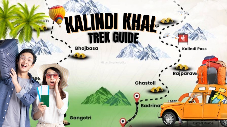
Kalindi Khal Trek Guide, Kalindi Khal Trek
The Kalindi Khal Trek Guide is for trekkers who dream of tackling one of the most extreme high-altitude expeditions in the Indian Himalayas. Known for its raw beauty, glacial crossings, and technical terrain, the Kalindi Khal Trek is often considered the toughest trekking trail in India. If you want a complete breakdown of the Kalindi Khal Trek Route, difficulty level, ideal season, and preparation tips, this guide covers it all in simple, beginner-friendly language. What Makes the Kalindi Khal Trek Special? This legendary trail connects Gangotri in Uttarakhand to Badrinath, crossing the massive Kalindi Pass at 5,947 m. You walk through crevassed glaciers, moraine fields, ice walls, and pristine alpine valleys terrain rarely seen on regular Himalayan treks. Kalindi Khal Trek Route Overview The Kalindi Khal Trek Route from Delhi to Delhi outlines the complete journey starting from Delhi, traveling to Gangotri, crossing the Kalindi Khal Pass, and ending at Badrinath before returning to Delhi. It includes all travel segments, acclimatization days, and high-altitude camps for better planning. The table below offers a clear day-wise breakdown of the entire expedition. Day Route / Activity Distance / Duration Altitude Notes Day 1 Delhi → Dehradun 250 km / 5–6 hrs 430 m Travel by flight/train/bus. Overnight in Dehradun. Day 2 Dehradun → Uttarkashi 170 km / 6–7 hrs 1,165 m Road journey; permits can be arranged here. Day 3 Uttarkashi → Gangotri 95 km / 4–5 hrs 3,100 m Start acclimatization; visit Gangotri Temple. Day 4 Gangotri → Bhojbasa 14 km trek / 5–6 hrs 3,800 m Gradual ascent along the Bhagirathi River. Day 5 Bhojbasa → Gaumukh → Tapovan 9–10 km / 6–7 hrs 4,463 m Gaumukh glacier viewpoint and steep climb to Tapovan. Day 6 Tapovan → Nandanvan 6–7 km / 4–5 hrs 4,500 m Traverse over the Gangotri Glacier. Day 7 Nandanvan → Vasuki Tal 7–8 km / 5–6 hrs 4,800 m Rocky sections and glacier crossings. Day 8 Vasuki Tal → Khara Patthar 6–7 km / 5 hrs 5,100 m High-altitude terrain; gradual but continuous ascent. Day 9 Khara Patthar → Suralaya Glacier / Kalindi Base 5–7 km / 4–5 hrs ~5,400 m Camp before the pass; technical terrain. Day 10 Cross Kalindi Khal Pass (5,947 m) → Raj Parav 10–12 hrs 5,947 m Toughest day; long glacier walks and ropework required. Day 11 Raj Parav → Ghastoli 10–12 km / 6–7 hrs 3,800 m Disconnect from glacier zone; army check post. Day 12 Ghastoli → Mana Village → Badrinath 15 km / 5–6 hrs 3,100 m Road connectivity starts at Mana. Day 13 Badrinath → Joshimath → Rishikesh 300 km / 9–10 hrs 372 m Return journey by road. Day 14 Rishikesh → Delhi 240 km / 5–6 hrs 430 m End of the Kalindi Khal Trek route. Highlights of the Route Kalindi Khal Trek Difficulty The Kalindi Khal Trek Difficulty is rated extremely challenging and is considered one of the toughest high-altitude treks in the Indian Himalayas. The route stays above 5,000 meters for several consecutive days, involves walking on glaciers, navigating deep crevasses, and using technical gear like crampons and ropes. Harsh weather, long trekking hours, and steep ascents demand excellent fitness, strong acclimatization, and prior experience with high-altitude or expedition-style trekking. The Kalindi Khal Trek Difficulty level is extremely challenging and suitable only for experienced trekkers or mountaineers. Why It’s Considered One of India’s Hardest Treks Who Should Attempt This Trek? If you’re new to expeditions, prepare with treks like Audens Col, Pangarchulla Peak, Stok Kangri (if open), or Kedartal. Kalindi Khal Trek Best Season (Season-Wise Breakdown) Understanding the season-wise conditions is crucial for planning the Kalindi Khal Trek, as weather directly impacts glacier stability, visibility, and safety. Here’s a detailed seasonal overview: Summer (May – Early June) Early Monsoon (Mid-June – Mid-July) – Best Season Peak Monsoon (Late July – August) Post-Monsoon (Early September – Early October) – Best Season Late Autumn & Winter (Mid-October – April) Kalindi Khal Trek – 12-Day Itinerary Day Route / Activity Distance / Duration Altitude Description Day 1 Arrive in Gangotri – 3,100 m Acclimatization, permit check, rest before the trek. Day 2 Gangotri → Bhojbasa 14 km / 5–6 hrs 3,800 m Trek along the Bhagirathi River via Chirbasa and rugged trails. Day 3 Bhojbasa → Gaumukh → Tapovan 9–10 km / 6–7 hrs 4,463 m Visit Gaumukh glacier, then climb steep sections to Tapovan. Day 4 Tapovan → Nandanvan 6–7 km / 4–5 hrs 4,500 m Traverse the Gangotri Glacier over rocks and ice. Day 5 Nandanvan → Vasuki Tal 7–8 km / 5–6 hrs 4,800 m Gradual ascent to a scenic high-altitude lake surrounded by peaks. Day 6 Vasuki Tal → Khara Patthar 6–7 km / 5 hrs 5,100 m Rocky and snowy terrain ideal for acclimatization. Day 7 Khara Patthar → Kalindi Base 5–7 km / 4–5 hrs ~5,400 m Trek to the base of Kalindi Khal Pass (Suralaya Glacier). Day 8 Cross Kalindi Khal Pass → Raj Parav 10–12 hrs 5,947 m (Pass) Toughest day with glacier traverse and ropework. Day 9 Raj Parav → Arwa Valley / Near Ghastoli 10–12 km / 6–7 hrs ~4,000 m Descend from glacier zone to safer terrain. Day 10 Trek to Ghastoli Army Camp 8–10 km / 4–5 hrs 3,800 m Easier terrain with streams and moraines. Day 11 Ghastoli → Mana Village → Badrinath 15 km trek + drive 3,100 m Trek to Mana, then drive to Badrinath. Day 12 Depart from Badrinath – 3,100 m Trip ends; drive toward Rishikesh/Haridwar. FAQs 1. How difficult is the Kalindi Khal Trek? It is one of the toughest Himalayan treks, requiring glacier skills, high-altitude experience, and excellent fitness. 2. What is the best season for the Kalindi Khal Trek? Mid-June to mid-July and early September to early October are the safest and most stable periods. 3. Do I need a guide for the trek? Yes. Due to glacier navigation and crevasse zones, a certified guide is mandatory. 4. How long is the Kalindi
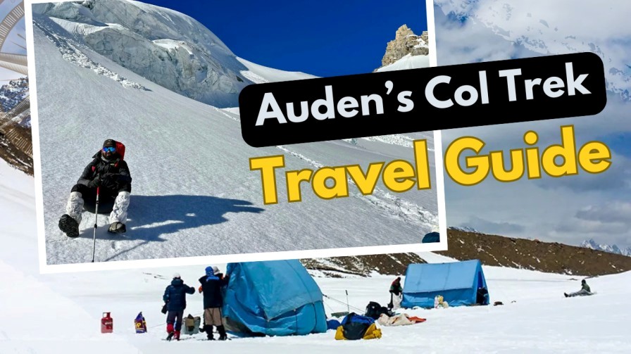
Auden’s Col Trek Itinerary & Experience: Ultimate Travel Guide
The Auden’s Col Trek is one of the most challenging and rewarding high-altitude expeditions in the Indian Himalayas. Connecting the Rudugaira Valley and Bhilangana Valley, this trek offers a mix of glaciers, steep ridges, remote valleys, and breath-taking Himalayan views. In this complete Auden’s Col Trek Guide, you’ll get a detailed Auden’s Col Trek Itinerary, preparation tips, route overview, difficulty level, and insights from real trekking experiences. What Makes the Auden’s Col Trek Special? The Auden’s Col Trek Experience is known for its raw wilderness and technical trails. It’s recommended only for seasoned trekkers with prior exposure to glacier travel. Best Time to Do the Auden’s Col Expedition The best time to do the Auden’s Col Expedition is during late spring to early summer (May–June) and post-monsoon autumn (September–early October). These windows offer stable weather, safer glacier conditions, and clear visibility—crucial for such a technical high-altitude route. May – June (Pre-Monsoon Season) Why chooses this season?Clearer skies, good snow bridges, and smoother ice conditions make this one of the safest times to attempt the pass. September – Early October (Post-Monsoon Season) Why chooses this season? post-monsoon clarity offers the best photography conditions and minimal weather disturbances—perfect for experienced trekkers. Seasons to Avoid July–August (Monsoon) November–April (Winter) Final Recommendation If you want the safest and most enjoyable Auden’s Col Trek Experience, plan your expedition in May–June or September–early October. Auden’s Col Trek Route Overview Day Route Altitude Day 1 Gangotri → Nala Camp 3,760 m Day 2 Nala Camp → Rudugaira Base Camp 4,350 m Day 3 Acclimatization Day — Day 4 Rudugaira BC → Gangotri Base Camp 4,500 m Day 5 Gangotri BC → Auden’s Col Base Camp 4,750 m Day 6 Base Camp → Auden’s Col → Khatling Glacier Camp 5,490 m Day 7 Glacier Camp → Zero Point → Chowki 3,600 m Day 8 Chowki → Masar Tal 4,135 m Day 9 Masar Tal → Vasuki Tal 4,135 m Day 10 Vasuki Tal → Kedarnath 3,583 m Day 11 Kedarnath → Gaurikund 1,982 m This trek demands technical skills, glacier equipment, and an experienced mountaineering guide. Auden’s Col Trek Itinerary (Detailed) Day 1: Gangotri to Nala Camp Start from Gangotri, moving through pine forests and narrow ridges. Easy-moderate ascent. Day 2: Nala Camp to Rudugaira Base Camp A steep climb with stunning views of Rudugaira Peak. Camp on a grassy patch. Day 3: Acclimatization Day Short hikes around the valley to prepare for altitude gain. Day 4: Rudugaira BC to Gangotri BC Walk on moraine fields, with clear views of Gangotri group peaks. Day 5: Gangotri BC to Auden’s Col Base Camp Route becomes trickier with crevasses and snow patches. Day 6: Auden’s Col Crossing The toughest day of the trek. A steep climb to the pass at 5,490 m, followed by a technical descent onto the Khatling Glacier. Day 7: Glacier Camp to Chowki A long glacier walks, requiring crampons and ropes. Reach Chowki, a beautiful meadow. Day 8: Chowki to Masar Tal Steep ascent to a pristine blue alpine lake. Day 9: Masar Tal to Vasuki Tal A scenic yet challenging day with rocky sections. Day 10: Vasuki Tal to Kedarnath Descend into the Kedarnath valley—great place to rest and visit the famous temple. Day 11: Kedarnath to Gaurikund Final descent through a well-paved trail. Auden’s Col Trek Experience: What to Expect The Auden’s Col Trek Experience is raw, challenging, and unforgettable. This is not a regular Himalayan trek—it’s a true expedition that demands fitness, technical skills, and mental strength. Expect long days on glaciers, rugged terrain, and breath-taking mountain views that make every step worth it. 1. Challenging & Technical Terrain You’ll walk across moraine fields, steep ice slopes, crevasse zones, and the massive Khatling Glacier. Crampons, ice axes, ropes, and harnesses are used throughout the high-altitude sections. This makes the trek feel like a real mountaineering experience. 2. High-Altitude Camping Campsites sit between 4,000–5,000 meters, offering stunning sunrise views but extremely cold nights. Expect limited facilities, no network connectivity, and complete silence—perfect for trekkers seeking pure isolation. 3. Long and Demanding Trekking Days Some days, especially the Auden’s Col Pass Crossing, can last 10–12 hours. The climb to the pass at 5,490 meters is steep and tiring, followed by a slow and careful descent onto the glacier. 4. Close-Up Views of Himalayan Giants During the trek, you’ll get unmatched views of Gangotri peaks, Jogin peaks, Kedar Dome, Thalay Sagar, and many more majestic summits. The vast snowfields and sharp ridgelines create a surreal, dramatic landscape. 5. A True Sense of Adventure Because the route is remote and less explored, you won’t meet many trekkers. The isolation, raw terrain, and technical crossings make this one of the toughest and most adventurous Himalayan expeditions in India. Fitness & Preparation Tips Essential Packing List How to Reach from Delhi to Gangotri From / Route Distance (km) Travel Time Notes Delhi → Dehradun 240 km 5–6 hrs (by road) Alternatively, flight: 50–60 min Dehradun → Uttarkashi 145 km 4–5 hrs Mountain roads, scenic route Uttarkashi → Gangotri (trek base) 100 km 4–5 hrs Narrow hilly roads Total Delhi → Gangotri ~485 km 13–15 hrs Combined road/air travel Gangotri → Nala Camp 7 km 2–3 hrs Trek starts here Nala Camp → Rudugaira Base Camp 8 km 4–5 hrs Moderate climb Rudugaira BC → Gangotri BC 7 km 3–4 hrs Slight ascent on moraines Gangotri BC → Auden’s Col Base Camp 8 km 4–5 hrs Steep & rocky trail Base Camp → Auden’s Col Pass → Khatling Glacier Camp 10 km 8–10 hrs Long glacier crossing, technical Glacier Camp → Zero Point → Chowki 8 km 6–7 hrs Alpine meadow trek Chowki → Masar Tal 7 km 4–5 hrs Rocky ascent Masar Tal → Vasuki Tal 6 km 3–4 hrs Moderate trail Vasuki Tal → Kedarnath 9 km 5–6 hrs Steep descent Kedarnath → Gaurikund 16 km 6–7 hrs Final downhill trek Total Trek Distance: 75 km over 10–12 days FAQs 1. How difficult is the Roopkund Trek?
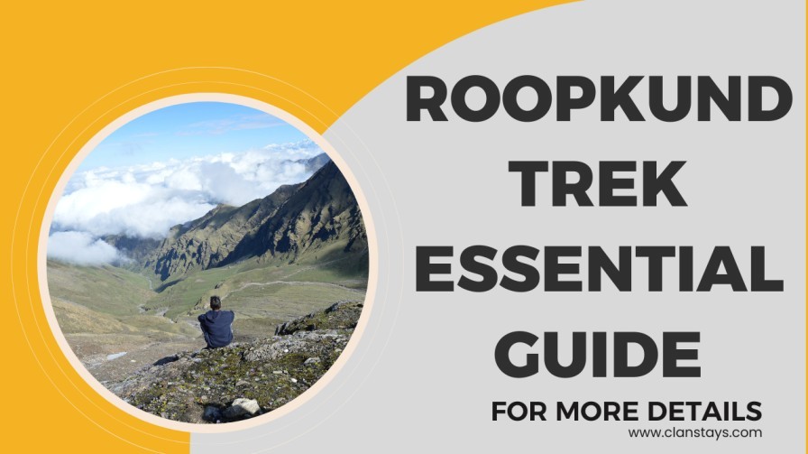
Everything You Need to Know Before Trekking to Roopkund
Planning the Roopkund Trek is unlike preparing for any ordinary hike. With its mysterious Skeleton Lake, alpine meadows, dramatic ridges, and snow-covered trails, it is one of India’s most thrilling high-altitude adventures. This comprehensive Roopkund Trek Guide covers everything you must know—difficulty, preparation, route details, costs, safety tips, and more. Whether you’re a seasoned trekker or stepping into high-altitude trekking for the first time, this guide will help you prepare smartly and trek safely. What Makes the Roopkund Lake Trek So Famous? The Roopkund Lake Trek is one of India’s most intriguing and adventurous high-altitude trails. What sets it apart is its perfect mix of mystery, natural beauty, mythology, and adrenaline—elements that few Himalayan treks offer together. The Mystery of “Skeleton Lake” Roopkund Lake is often called Skeleton Lake because of the hundreds of ancient human skeletons discovered at its bottom.These remains date back nearly 1,200 years, believed to be victims of a sudden, violent hailstorm according to modern research.This eerie discovery continues to attract historians, scientists, and trekkers worldwide. Stunning High-Altitude Alpine Meadows The trek passes through two of India’s most beautiful bugyals (meadows): These vast green carpets offer breath taking 360° views of the surrounding Himalayan peaks. They’re often listed among the most scenic alpine meadows on earth. Close-Up Views of Mighty Himalayan Peaks The trail offers dramatic views of major Himalayan giants, including: For many trekkers, these views alone make the journey worthwhile. Adventure-Packed Terrain The Roopkund Lake Trek features a variety of landscapes in a short span: This diversity makes the trek both exciting and challenging. A Deep Connection to Folk Culture & Mythology Roopkund is closely linked to the Nanda Devi Raj Jat Yatra, a grand pilgrimage that takes place once every 12 years.The trail is lined with stories, local legends, and cultural significance, adding spiritual depth to the journey. Best Time for the Roopkund Trek (Season-Wise Guide) Choosing the right trekking window is crucial for safety, visibility, and overall experience on the Roopkund Trek. Since Roopkund is a high-altitude expedition (5,029 m), weather conditions vary dramatically across the year. Below is a detailed, season-wise breakdown so you can plan perfectly. Spring (March – April) Trekking Status: Not recommended Weather & Conditions Should You Go? No. The route is generally inaccessible and unsafe during early spring. Summer (May – June) Trekking Status: Highly recommended Weather & Conditions Why Trek Now? Monsoon (July – August) Trekking Status: Not recommended Weather & Conditions Should You Go? Definitely NO. Trekking is risky and often restricted. Autumn (September – October) Trekking Status: Peak season Weather & Conditions Why Trek Now? Winter (November – February) Trekking Status: Not possible Weather & Conditions Should You Go? NO. Roopkund remains completely closed in winter. Roopkund Trek Information: Route & Itinerary A standard itinerary span 7–8 days. Below is the most common route followed by trekking groups. Day Route Altitude Day 1 Lohajung 2,300 m Day 2 Lohajung → Didna 2,450 m Day 3 Didna → Ali Bugyal 3,350 m Day 4 Ali Bugyal → Ghora Lotani 3,900 m Day 5 Ghora Lotani → Bhagwabasa 4,600 m Day 6 Bhagwabasa → Roopkund → Return 5,029 m Day 7 Descent to Lohajung — Day 8 Departure — Essential Packing List for the Roopkund Trek Roopkund Trek Tips for First-Time Trekkers Follow these expert suggestions to stay safe and enjoy the trek fully. Safety Tips Altitude Tips Environmental Tips How to Reach Roopkund from Delhi Mode of Transport Route / Nearest Place Distance from Delhi Approx. Travel Time By Road Delhi → Lohajung (trek base) 520 km 12–14 hours By Train Delhi → Kathgodam → Rishikesh → Lohajung 280 km (Delhi to Kathgodam) + 240 km (Kathgodam → Lohajung) 12–14 hours total By Air Delhi → Pantnagar Airport → Lohajung 250 km (by road from Pantnagar) 8–10 hours total Nearest Town for Supplies Joshimath 540 km 12–13 hours from Delhi, then 8–10 hours to Lohajung by road Trek Starting Point Lohajung km (base camp) — FAQs 1. How difficult is the Roopkund Trek? The Roopkund Trek is considered moderate to difficult, requiring good fitness and prior trekking experience. 2. Is Roopkund Lake still accessible? Yes, but accessibility depends on weather and forest department permissions. Always check the latest updates before planning. 3. What permits are required for the Roopkund Trek? You may need local forest permits and a medical fitness certificate. Most trek organizers handle this. 4. What is the best month to do the Roopkund Lake Trek? The best months are May–June and September–October. 5. Is it safe for solo trekkers? Solo trekking is not recommended due to the challenging terrain. Join a trusted trekking group for safety. Why Clan Stays Should Be Your Go-To Travel Partner Choosing Clan Stays as your travel partner ensures a seamless and memorable journey from start to finish. With years of experience in curating personalized travel experiences, they combine safety, comfort, and local expertiseto make every trip stress-free. Whether it’s high-altitude treks, cultural tours, or offbeat destinations, Clan Stays takes care of all logistics so you can focus on enjoying the adventure. Their dedicated team prioritizes customer satisfaction, making them a trusted choice for travellers seeking reliable and hassle-free travel experiences.